
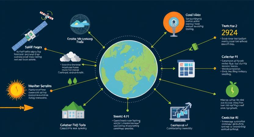
Technological advancements in monitoring environmental changes

From satellite imaging to weather radars and geographic information systems, the array of technological tools available for monitoring environmental changes continues to expand rapidly. These advancements allow us to track weather patterns, detect geological movements, and map out disaster-prone areas with unprecedented accuracy. With the integration of Internet of Things (IoT) sensors and high-performance computing, real-time data collection and analysis have become more efficient, enabling quicker responses to potential natural disasters.
Additionally, the utilization of artificial intelligence and machine learning algorithms has revolutionized predictive modeling for environmental monitoring. By analyzing vast amounts of data and identifying patterns that may indicate impending changes in the environment, these technologies offer invaluable insights for forecasting disasters with greater precision. As these tools evolve, the ability to anticipate and mitigate the impact of environmental changes is steadily advancing, providing a crucial advantage in efforts to safeguard communities and ecosystems from potential risks.
• With satellite imaging, weather radars, and Geographic Information Systems (GIS), environmental changes can be monitored more accurately.
• Integration of Internet of Things (IoT) sensors and high-performance computing allows for real-time data collection and analysis.
• Artificial intelligence and machine learning algorithms have revolutionized predictive modeling for environmental monitoring.
• These technologies offer invaluable insights for forecasting disasters with greater precision.
• Advancements in monitoring technology help anticipate and mitigate the impact of environmental changes, safeguarding communities and ecosystems.
Remote sensing tools for early detection of natural disasters
Remote sensing tools play a crucial role in the early detection of natural disasters. These tools involve the use of satellites and ground-based sensors to monitor various environmental parameters that could indicate an impending disaster. By analyzing changes in vegetation, land surface temperature, and weather patterns, remote sensing tools can provide valuable data for predicting events such as wildfires, floods, and landslides.
One key advantage of remote sensing tools is their ability to cover large geographic areas, making it possible to detect potential disasters in remote or inaccessible regions. Additionally, the real-time data collected by these tools allows for rapid response and coordination among emergency services and disaster management agencies. By harnessing the power of remote sensing technology, authorities can improve their preparedness and response strategies, ultimately helping to minimize the impact of natural disasters on human lives and infrastructure.
• Remote sensing tools involve the use of satellites and ground-based sensors
• These tools monitor environmental parameters to detect impending disasters
• Changes in vegetation, land surface temperature, and weather patterns are analyzed
• Data from remote sensing tools can help predict events like wildfires, floods, and landslides
One key advantage of remote sensing tools is their ability to cover large geographic areas. This makes it possible to detect potential disasters in remote or inaccessible regions. Additionally, the real-time data collected by these tools allows for rapid response and coordination among emergency services and disaster management agencies. By harnessing the power of remote sensing technology, authorities can improve their preparedness and response strategies. Ultimately, this helps minimize the impact of natural disasters on human lives and infrastructure.
Utilizing artificial intelligence for predictive modeling
Technological advancements have paved the way for the utilization of artificial intelligence in predictive modeling. AI algorithms are being harnessed to analyze vast amounts of data and identify patterns that may indicate the possibility of impending natural disasters. These predictive models can offer valuable insights into potential threats, enabling authorities to take proactive measures to mitigate risks and protect vulnerable populations.
By incorporating artificial intelligence into predictive modeling, researchers and disaster management agencies can enhance their ability to forecast disasters with greater accuracy and efficiency. Machine learning algorithms can be fine-tuned to process real-time data from various sources, allowing for quicker detection of warning signs and more precise predictions of potential disaster scenarios. The integration of AI in predictive modeling represents a significant advancement in disaster preparedness efforts, offering the potential to save lives and minimize the impact of catastrophic events.
• Artificial intelligence algorithms analyze vast amounts of data
• Identify patterns indicating potential natural disasters
• Predictive models offer valuable insights for proactive measures
• Enhance forecasting accuracy and efficiency with AI in predictive modeling
• Machine learning algorithms process real-time data for quicker detection
• Integration of AI represents significant advancement in disaster preparedness efforts
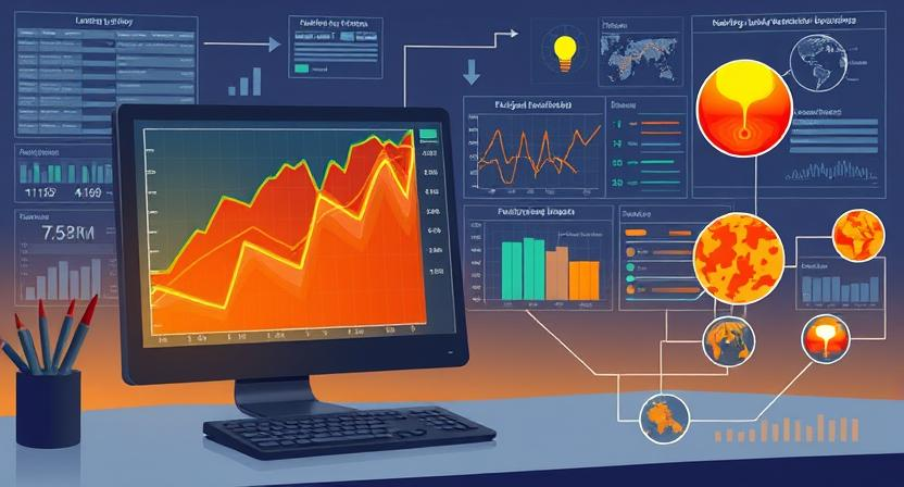
The importance of data analytics in forecasting disasters
Data analytics plays a crucial role in the realm of disaster forecasting by harnessing the power of extensive datasets to identify patterns and trends that could signify potential calamities. By analyzing various data points such as historical records, weather patterns, geographical information, and social media activity, data analytics helps experts in predicting disasters with more accuracy and timeliness. This analytical approach enables authorities to take proactive measures in mitigating the impact of disasters, potentially saving lives and reducing economic losses.
Incorporating data analytics into disaster forecasting not only enhances the ability to predict impending events but also provides valuable insights for decision-making and resource allocation. The utilization of advanced algorithms and analytical tools allows for the interpretation of vast amounts of data in real-time, facilitating rapid response and informed decision-making during critical situations. Moreover, by continuously refining and updating predictive models based on new data inputs, data analytics contributes to the evolution of more effective disaster forecasting strategies that are adaptive to changing circumstances and emerging risks.
• Data analytics harnesses extensive datasets to identify patterns and trends in disaster forecasting
• Analyzing various data points such as historical records, weather patterns, geographical information, and social media activity enhances prediction accuracy
• Proactive measures can be taken by authorities to mitigate the impact of disasters with timely predictions
• Advanced algorithms and analytical tools enable real-time interpretation of vast amounts of data for rapid response
• Continuous refinement of predictive models based on new data inputs leads to more effective disaster forecasting strategies
Integration of Internet of Things (IoT) in disaster prediction systems
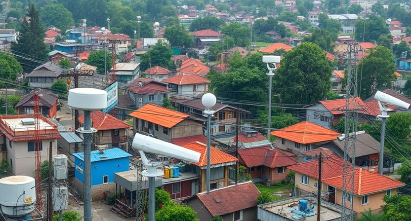
Incorporating Internet of Things (IoT) devices into disaster prediction systems has revolutionized how we gather data and monitor environmental changes. These interconnected devices collect real-time information on various parameters such as temperature, humidity, air quality, and seismic activity. By leveraging IoT technology, emergency responders and scientists can analyze this data to detect early warning signs of potential disasters.
The seamless integration of IoT devices allows for continuous monitoring of disaster-prone areas, enabling authorities to better prepare for and respond to emergencies. These smart devices can communicate with each other to provide a comprehensive view of the situation, helping in the prediction and mitigation of natural calamities. Moreover, IoT technology enhances the efficiency of disaster response efforts by enabling quick decision-making based on accurate and up-to-date information gathered from various sensors and devices.
• IoT devices collect real-time data on parameters like temperature, humidity, air quality, and seismic activity
• Data analysis helps in detecting early warning signs of potential disasters
• Continuous monitoring of disaster-prone areas is enabled by IoT integration
• Smart devices communicate to provide a comprehensive view of the situation for better prediction and mitigation efforts
• Quick decision-making based on accurate information enhances efficiency in disaster response
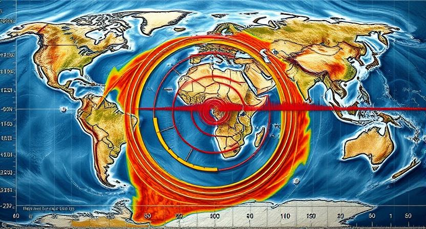
Satellite imagery for tracking weather patterns and geological movements
Satellite imagery plays a pivotal role in tracking various environmental changes, serving as a valuable tool in monitoring weather patterns and geological movements. By capturing high-resolution images from space, satellites provide real-time data that helps meteorologists predict and track storms, hurricanes, and other weather phenomena with greater accuracy. This enables early warning systems to be activated, providing crucial information to communities in the path of impending disasters.
Moreover, satellite imagery is instrumental in monitoring geological movements such as land shifts, volcanic eruptions, and earthquake precursors. The data obtained from satellite observations aid in the continuous monitoring of vulnerable areas, allowing for the timely identification of potential hazards. By analyzing these images, scientists and researchers can gain valuable insights into the dynamic processes shaping our planet, ultimately contributing to better disaster preparedness and mitigation strategies.
• Satellite imagery provides high-resolution images from space
• Helps meteorologists predict and track storms, hurricanes, and other weather phenomena
• Enables early warning systems to be activated for impending disasters
• Instrumental in monitoring geological movements like land shifts, volcanic eruptions, and earthquake precursors
• Data aids in continuous monitoring of vulnerable areas
• Allows for timely identification of potential hazards
• Scientists and researchers gain valuable insights into dynamic processes shaping our planet
Weather radars for monitoring storm formations
Weather radars play a crucial role in monitoring storm formations by detecting precipitation, measuring intensity, and tracking movement. These advanced radar systems provide real-time data on the development of severe weather conditions, enabling meteorologists to issue timely warnings and alerts to the public. By utilizing radar technology, forecasters can accurately identify the formation of tornadoes, hurricanes, thunderstorms, and other potentially hazardous weather events, helping communities prepare and take necessary precautions.
The data collected from weather radars also aids in predicting the path and intensity of storms, allowing emergency management agencies to coordinate evacuation efforts and allocate resources effectively. With the ability to visualize weather patterns and detect sudden changes in atmospheric conditions, weather radars serve as an essential tool in mitigating the impact of severe weather events on both property and human lives. By continuously monitoring storm formations, meteorologists can provide vital information to the public, helping individuals and communities stay safe during periods of inclement weather.
• Weather radars detect precipitation, measure intensity, and track movement
• Real-time data provided by radar systems helps meteorologists issue timely warnings
• Radar technology accurately identifies formation of tornadoes, hurricanes, thunderstorms
• Data collected aids in predicting path and intensity of storms for effective evacuation efforts
• Weather radars visualize weather patterns and detect sudden changes in atmospheric conditions
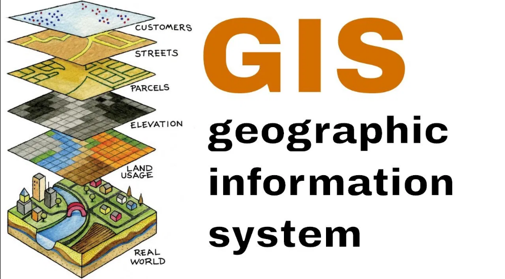
Geographic Information Systems (GIS) for mapping disaster-prone areas
Geographic Information Systems (GIS) play a pivotal role in identifying and mapping disaster-prone areas. By utilizing GIS technology, data on various environmental factors such as topography, land use, and historical disaster incidents can be integrated to create comprehensive maps that highlight regions at higher risk of natural disasters. These maps provide valuable insights for policymakers, urban planners, and emergency responders to implement effective mitigation strategies and emergency preparedness plans.
Moreover, GIS enables the visualization of complex spatial data, allowing stakeholders to better understand the spatial relationships between different elements that contribute to the vulnerability of certain areas. This spatial analysis helps in evaluating the potential impact of natural disasters on infrastructure, communities, and the environment within disaster-prone zones. With the aid of GIS mapping, decision-makers can prioritize resource allocation, establish evacuation routes, and enhance resilience in the face of impending disasters.
• GIS technology integrates data on environmental factors to create maps of disaster-prone areas
• Maps provide insights for policymakers, urban planners, and emergency responders
• Visualization of spatial data helps stakeholders understand vulnerability of areas
• Spatial analysis evaluates potential impact of natural disasters on infrastructure and communities
• Decision-makers can prioritize resource allocation and establish evacuation routes with GIS mapping
Mobile applications for real-time alerts and warnings

Mobile applications for real-time alerts and warnings play a crucial role in helping individuals and communities stay informed and prepared for impending disasters. With the convenience of having information at their fingertips, users can receive immediate notifications about weather alerts, potential hazards, or evacuation orders, enabling them to take necessary precautions in a timely manner. These apps leverage geolocation technology to provide location-specific alerts, ensuring that users receive relevant information based on their current whereabouts.
In addition to receiving alerts, mobile applications for real-time alerts and warnings often offer a range of features to enhance preparedness and response efforts. Users can access emergency contact information, evacuation routes, shelter locations, and safety tips directly through the app, empowering them to make informed decisions during times of crisis. Moreover, some apps enable users to report incidents or request assistance, facilitating swift communication with emergency responders and potentially saving lives in emergency situations.
• Mobile applications for real-time alerts and warnings are essential for keeping individuals and communities informed about impending disasters
• Users can receive immediate notifications about weather alerts, potential hazards, or evacuation orders
• These apps use geolocation technology to provide location-specific alerts based on the user’s current whereabouts
• In addition to receiving alerts, these mobile applications offer features such as emergency contact information, evacuation routes, shelter locations, and safety tips
• Users can access crucial information directly through the app to make informed decisions during times of crisis
• Some apps allow users to report incidents or request assistance, facilitating communication with emergency responders in emergency situations
Crowdsourcing data for enhancing predictive capabilities
Crowdsourcing data involves collecting information from a large group of individuals to enhance predictive capabilities in disaster forecasting. By tapping into the collective knowledge and experiences of a diverse pool of contributors, valuable insights and real-time data can be gathered to improve the accuracy and timeliness of predictions. This collaborative approach allows for a broader range of information to be collected, leading to more robust disaster risk assessments and early warning systems.
Through crowdsourcing data, emergency management agencies and researchers can leverage the power of the crowd to gather data on various environmental factors, such as weather patterns, geological activities, and social behaviors. This wealth of information enables a more comprehensive analysis of potential risks and vulnerabilities, ultimately aiding in the development of proactive measures to mitigate the impact of disasters. By harnessing the collective intelligence of the crowd, predictive capabilities can be strengthened, helping to save lives and protect communities from the devastating effects of natural disasters.
• Crowdsourcing data involves collecting information from a large group of individuals to enhance predictive capabilities in disaster forecasting.
• By tapping into the collective knowledge and experiences of a diverse pool of contributors, valuable insights and real-time data can be gathered to improve the accuracy and timeliness of predictions.
• This collaborative approach allows for a broader range of information to be collected, leading to more robust disaster risk assessments and early warning systems.
• Through crowdsourcing data, emergency management agencies and researchers can leverage the power of the crowd to gather data on various environmental factors such as weather patterns, geological activities, and social behaviors.
• This wealth of information enables a more comprehensive analysis of potential risks and vulnerabilities, ultimately aiding in the development of proactive measures to mitigate the impact of disasters.
• By harnessing the collective intelligence of the crowd, predictive capabilities can be strengthened helping save lives and protect communities from natural disasters.
High-performance computing for complex simulations
High-performance computing plays a crucial role in conducting complex simulations for predicting natural disasters with higher accuracy. These systems utilize advanced processing capabilities to run intricate models that consider various environmental factors and scenarios. By harnessing the power of high-performance computing, researchers and scientists can simulate different disaster situations and evaluate potential outcomes, enabling better preparedness and response strategies.
The ability of high-performance computing to handle large datasets and perform rapid calculations allows for more detailed and comprehensive disaster simulations. This technology enables experts to analyze intricate relationships between different variables, such as weather patterns, terrain topography, and population density. Through these simulations, authorities can assess the potential impact of disasters, assess the effectiveness of mitigation measures, and plan for efficient response and recovery operations.
• High-performance computing is essential for conducting complex simulations to predict natural disasters accurately.
• These systems use advanced processing capabilities to run intricate models considering various environmental factors and scenarios.
• Researchers and scientists can simulate different disaster situations and evaluate potential outcomes using high-performance computing.
• The technology allows for more detailed and comprehensive disaster simulations by handling large datasets and performing rapid calculations.
• Experts can analyze relationships between variables like weather patterns, terrain topography, and population density through these simulations.
• Authorities can assess the potential impact of disasters, effectiveness of mitigation measures, and plan efficient response operations with the help of high-performance computing.
Social media analysis for detecting early warning signs
Social media analysis plays a crucial role in the early detection of potential natural disasters. By monitoring social media platforms, researchers and authorities can gather real-time data on emerging trends, public sentiment, and on-the-ground observations. This information can provide valuable insights into potential risks and help in issuing timely warnings to at-risk populations.
Utilizing advanced algorithms and sentiment analysis tools, social media data can be sifted through to identify unusual patterns, spikes in relevant keywords, and geotagged posts indicating unusual activities. This proactive approach enables authorities to stay ahead of disaster events and implement necessary preparedness measures. Additionally, social media analysis serves as a valuable tool for validating information received from traditional sources and enhancing overall situational awareness during critical times.
• Social media analysis is crucial for early detection of potential natural disasters
• Real-time data on emerging trends, public sentiment, and on-the-ground observations can be gathered
• Valuable insights into potential risks can be obtained to issue timely warnings to at-risk populations
• Advanced algorithms and sentiment analysis tools help identify unusual patterns and spikes in relevant keywords
• Geotagged posts indicating unusual activities can be identified through social media analysis
• Proactive approach enables authorities to stay ahead of disaster events and implement necessary preparedness measures
Automated drones for assessing damage post-disaster
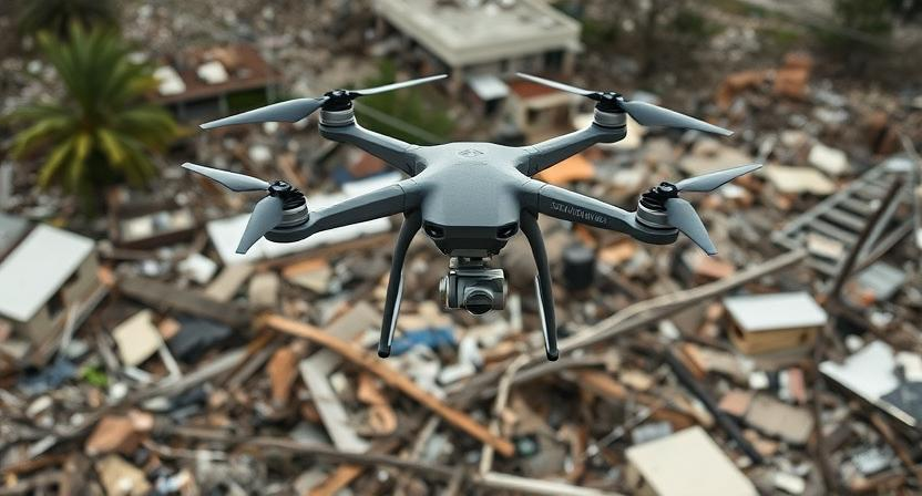
Automated drones have revolutionized the way damage is assessed post-disaster. These unmanned aerial vehicles are equipped with high-resolution cameras and sensors, allowing them to capture detailed images of affected areas from above. By flying over disaster-stricken regions, drones can quickly survey the extent of destruction, providing valuable information to emergency responders and decision-makers.
The ability of automated drones to reach inaccessible or hazardous locations makes them invaluable tools in post-disaster assessment. Their agility and maneuverability enable them to navigate through debris and rubble, capturing images that help identify areas in need of immediate attention. By streamlining the assessment process, drones contribute to faster response times and more efficient allocation of resources in the aftermath of a natural disaster.
• Automated drones have revolutionized the way damage is assessed post-disaster.
• Unmanned aerial vehicles are equipped with high-resolution cameras and sensors.
• Drones can quickly survey the extent of destruction in disaster-stricken regions.
• Their agility and maneuverability enable them to navigate through debris and rubble.
• Drones help identify areas in need of immediate attention for faster response times.
Virtual reality for training emergency responders
Emerging technologies like virtual reality (VR) are revolutionizing the way emergency responders are trained for various disaster scenarios. By simulating realistic and immersive environments, VR allows responders to practice their skills in a safe yet effective manner. Through interactive simulations, trainees can experience critical incidents first-hand, enhancing their decision-making abilities and overall preparedness for real-life emergencies.
VR training modules can replicate hazardous situations such as building collapses, wildfires, or chemical spills, providing responders with valuable hands-on experience without exposing them to actual risks. These realistic simulations help individuals develop muscle memory, improve coordination, and foster teamwork in high-pressure environments. Additionally, VR training can be tailored to specific job roles and scenarios, ensuring that responders receive personalized instruction that meets their unique training needs.
• VR training modules can replicate hazardous situations such as building collapses, wildfires, or chemical spills
• Provides responders with valuable hands-on experience without exposing them to actual risks
• Helps individuals develop muscle memory, improve coordination, and foster teamwork in high-pressure environments
• Can be tailored to specific job roles and scenarios for personalized instruction
Blockchain technology for secure data sharing among agencies
Blockchain technology has emerged as a robust solution for secure data sharing among various agencies involved in disaster response and management. By using a decentralized and tamper-proof system, blockchain ensures that sensitive information is shared securely and transparently. This technology creates a permanent and immutable record of data exchanges, enhancing trust and accountability among different stakeholders.
Moreover, blockchain enables agencies to streamline their operations by facilitating real-time data sharing without compromising on security. The use of smart contracts on the blockchain platform allows for automated and secure transactions, reducing the risk of human error or fraud. Overall, the adoption of blockchain technology in disaster management not only enhances the efficiency of data sharing but also plays a pivotal role in ensuring the integrity and confidentiality of critical information.
• Blockchain technology provides a decentralized and tamper-proof system for secure data sharing
• It creates a permanent and immutable record of data exchanges, enhancing trust among stakeholders
• Streamlines operations by enabling real-time data sharing without compromising security
• Smart contracts on the blockchain platform allow for automated and secure transactions, reducing risks of human error or fraud
Predictive analytics for predicting the impact of disasters
Predictive analytics play a crucial role in estimating the potential impact of disasters on communities and infrastructure. By analyzing historical data, trends, and patterns, predictive models can forecast the scale and scope of disasters, enabling authorities to prepare and allocate resources effectively. These analytics help in prioritizing areas at higher risk, devising evacuation plans, and implementing mitigation strategies to minimize the impact of natural calamities.
Moreover, predictive analytics provide valuable insights into the aftermath of disasters, facilitating quick response and recovery efforts. By predicting the extent of damage, authorities can mobilize emergency services, allocate medical supplies, and coordinate relief efforts efficiently. These predictive models also assist in assessing infrastructure vulnerabilities, thereby enabling preventive measures to enhance resilience and reduce the long-term impact of disasters on communities.
• Predictive analytics analyze historical data, trends, and patterns
• Forecast the scale and scope of disasters
• Enable authorities to prepare and allocate resources effectively
• Prioritize areas at higher risk
• Devise evacuation plans and implement mitigation strategies
Furthermore, predictive analytics offer valuable insights into the aftermath of disasters. This facilitates quick response and recovery efforts by predicting the extent of damage. Authorities can then mobilize emergency services, allocate medical supplies, and coordinate relief efforts efficiently. These predictive models also help in assessing infrastructure vulnerabilities, enabling preventive measures to enhance resilience and reduce the long-term impact of disasters on communities.
By utilizing predictive analytics for disaster prediction, authorities can make informed decisions based on data-driven insights. This proactive approach not only saves lives but also minimizes economic losses by preparing for potential disasters in advance. The use of advanced technology in predictive modeling continues to evolve, providing more accurate forecasts and improving disaster preparedness strategies globally.
• Make informed decisions based on data-driven insights
• Proactive approach saves lives and minimizes economic losses
• Advanced technology improves accuracy of forecasts
• Enhance disaster preparedness strategies globally
Machine learning algorithms for pattern recognition in historical data
Machine learning algorithms play a vital role in analyzing historical data to identify patterns that can assist in predicting future natural disasters. By processing vast amounts of information from past events, these algorithms can uncover correlations and trends that might not be readily apparent to human analysts. This allows for more accurate forecasting of potential disasters and helps in developing early warning systems to mitigate their impact.
Through the application of machine learning algorithms, researchers can extract valuable insights from historical disaster data, enabling them to recognize precursory signals that indicate the likelihood of specific events occurring. By training these algorithms on diverse sets of past data, such as earthquake occurrences, storm patterns, or flood dynamics, predictive models can be fine-tuned to enhance their reliability and precision. This sophisticated analysis of historical data aids in devising proactive measures and resource allocation strategies, ultimately minimizing the devastation caused by natural calamities.
• Machine learning algorithms are essential for analyzing historical data to identify patterns
• These algorithms can uncover correlations and trends that may not be apparent to human analysts
• Accurate forecasting of potential disasters is possible with the help of machine learning algorithms
• Early warning systems can be developed using insights from historical data
• Researchers can recognize precursory signals indicating the likelihood of specific events through machine learning algorithms
• Training these algorithms on diverse sets of past data enhances their reliability and precision
• Proactive measures and resource allocation strategies can be devised based on sophisticated analysis of historical data
Climate models for long-term forecasting of natural disasters
Climate models play a crucial role in predicting natural disasters over longer time horizons by analyzing various climatic parameters. By inputting data on temperature, precipitation, wind patterns, and other environmental factors into these models, scientists can simulate potential scenarios and anticipate the likelihood of disasters such as hurricanes, droughts, or floods occurring in the future.
These long-term forecasting models provide valuable insights to policymakers, emergency responders, and communities at risk, allowing them to better prepare and mitigate the impact of potential disasters. By understanding the potential changes in climate patterns and their associated risks, proactive measures can be taken to enhance resilience and reduce vulnerabilities in regions prone to certain types of natural disasters.
• Climate models analyze temperature, precipitation, wind patterns, and other environmental factors
• Scientists simulate potential disaster scenarios based on input data
• Predictions help policymakers, emergency responders, and communities prepare for disasters
• Understanding climate pattern changes allows for proactive measures to enhance resilience
• Long-term forecasting helps reduce vulnerabilities in disaster-prone regions
Artificial neural networks for predicting earthquake occurrences
Artificial neural networks have emerged as a promising tool for predicting earthquake occurrences with improved accuracy. These advanced systems are designed to mimic the human brain’s ability to learn and adapt, making them highly effective in analyzing complex patterns within seismic data. By training neural networks on vast amounts of historical earthquake data, researchers can enhance their understanding of the precursory signals that indicate an impending earthquake.
Through the utilization of artificial neural networks, scientists can analyze various factors such as fault lines, stress buildup, and previous seismic activity to identify spatial and temporal patterns that precede earthquakes. This computational approach enables early detection and prediction of potential seismic events, offering valuable insights for disaster preparedness and mitigation efforts. By continuously refining neural network models with real-time data inputs, researchers can improve the accuracy of earthquake forecasts and ultimately contribute to saving lives and minimizing the impact of these natural disasters.
• Artificial neural networks mimic the human brain’s ability to learn and adapt
• Training on vast amounts of historical earthquake data enhances understanding of precursory signals
• Analysis of factors like fault lines, stress buildup, and previous seismic activity aids in identifying patterns
• Early detection and prediction of potential seismic events for disaster preparedness
• Continuous refinement with real-time data inputs improves accuracy of earthquake forecasts
Hybrid forecasting systems for more accurate predictions
Hybrid forecasting systems harness the power of combining multiple prediction models to enhance the accuracy of disaster forecasts. By amalgamating various methodologies, such as artificial intelligence, machine learning, and numerical simulations, these systems can provide more reliable predictions for a diverse range of natural calamities.
The strength of hybrid forecasting lies in its ability to offset the limitations of individual models by leveraging the unique strengths of each component. By integrating data from diverse sources and utilizing advanced algorithms, these systems offer a comprehensive approach to predicting disasters with increased precision and efficiency.
• Hybrid forecasting systems combine multiple prediction models
• Utilize methodologies like artificial intelligence, machine learning, and numerical simulations
• Provide more reliable predictions for natural calamities
• Offset limitations of individual models by leveraging unique strengths of each component
• Integrate data from diverse sources and utilize advanced algorithms
• Offer a comprehensive approach to predicting disasters with increased precision and efficiency


