
The Evolution of Satellite Technology
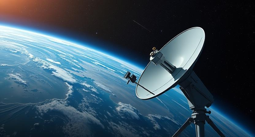
Satellites have come a long way since their inception, evolving from simple communication tools to multifaceted devices serving various purposes. Initially used primarily for transmitting signals across long distances, satellites have now advanced to incorporate a wide array of functions. Over the years, technological advancements have enabled satellites to not only facilitate communication but also to provide crucial data for weather forecasting, environmental monitoring, and navigation systems.
One of the significant milestones in the evolution of satellite technology was the development of remote sensing capabilities. This innovation allowed satellites to capture high-resolution images of the Earth’s surface, revolutionizing fields such as cartography, agriculture, and disaster management. With the continuous enhancement of satellite sensors and imaging techniques, the scope of satellite technology has expanded significantly, making it an indispensable tool in various sectors across the globe.
• Satellites have evolved from simple communication tools to multifaceted devices
• Initially used for transmitting signals, now serve various purposes
• Technological advancements have enabled satellites to provide crucial data for weather forecasting, environmental monitoring, and navigation systems
• Development of remote sensing capabilities was a significant milestone in satellite technology evolution
• Remote sensing allowed satellites to capture high-resolution images of Earth’s surface
• Revolutionized fields such as cartography, agriculture, and disaster management
• Continuous enhancement of satellite sensors and imaging techniques has expanded the scope of satellite technology
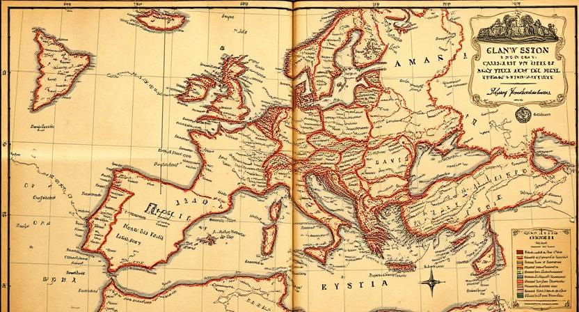
Advantages of Using Satellite Imagery in Mapping
Satellite imagery in mapping offers unparalleled advantages in providing detailed and up-to-date information about the Earth’s surface. By capturing images from space, satellites can cover vast areas quickly and efficiently, allowing for comprehensive mapping of remote or inaccessible locations. This widespread coverage enables mapping professionals to obtain a broad view of the landscape, facilitating better decision-making in various industries such as urban planning, agriculture, and environmental monitoring.
Furthermore, satellite imagery provides a valuable tool for monitoring changes over time. With historical imagery archives, analysts can track land use changes, deforestation, urban expansion, and other environmental transformations. This historical perspective helps in understanding long-term trends and assessing the impact of human activities on the environment, aiding in sustainable development planning and resource management.
• Satellite imagery offers unparalleled advantages in providing detailed and up-to-date information about the Earth’s surface
• Satellites can cover vast areas quickly and efficiently, allowing for comprehensive mapping of remote or inaccessible locations
• Enables mapping professionals to obtain a broad view of the landscape, facilitating better decision-making in various industries such as urban planning, agriculture, and environmental monitoring
• Provides a valuable tool for monitoring changes over time
• Historical imagery archives help analysts track land use changes, deforestation, urban expansion, and other environmental transformations
• Helps in understanding long-term trends and assessing the impact of human activities on the environment
• Aids in sustainable development planning and resource management
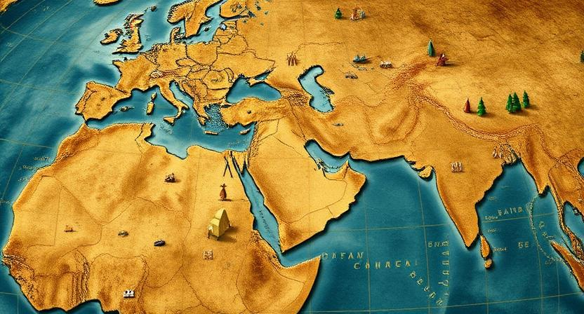
How Satellites Capture Images of Earth
Satellites capture images of Earth using specialized sensors and cameras on board. These sensors are designed to detect various wavelengths of light, including visible light, infrared, and microwave radiation. By capturing light reflecting off the Earth’s surface, satellites can create detailed images that provide valuable information for a wide range of applications.
The process of capturing images involves the satellite orbiting the Earth at specific intervals, collecting data as it passes over different locations. The sensors on board the satellite then convert this data into digital images, which are transmitted back to Earth for further processing and analysis. This continuous monitoring allows satellites to capture images of Earth’s surface with high spatial resolution, enabling researchers and professionals to track changes, monitor natural disasters, and make informed decisions based on the gathered information.
• Satellites use specialized sensors and cameras to capture images of Earth
• Sensors detect various wavelengths of light, including visible light, infrared, and microwave radiation
• Data collected by satellites is converted into digital images for further processing
• Continuous monitoring allows high spatial resolution images to be captured
• Images provide valuable information for tracking changes, monitoring natural disasters, and making informed decisions
Different Types of Satellite Sensors
Satellites use a variety of sensors to capture images and data from Earth’s surface. Optical sensors are commonly used to collect visible and infrared light, providing high-resolution images for mapping and monitoring purposes. These sensors are equipped with different spectral bands to capture specific wavelengths of light, allowing for the differentiation of land cover types and the detection of changes over time.
In addition to optical sensors, satellites also utilize radar sensors to penetrate through clouds and darkness, offering all-weather imaging capabilities. Radar sensors emit microwave pulses towards the Earth’s surface and measure the reflected signals, which can be used to map topography, monitor vegetation, and detect changes in the Earth’s surface. By combining data from optical and radar sensors, satellite imagery can provide a comprehensive view of various environmental parameters for a wide range of applications.
• Optical sensors are commonly used to collect visible and infrared light
• Equipped with different spectral bands to capture specific wavelengths of light
• Used for mapping and monitoring purposes
• Radar sensors penetrate through clouds and darkness
• Emit microwave pulses towards Earth’s surface
• Measure reflected signals for mapping topography, monitoring vegetation, and detecting changes in the Earth’s surface
• Combining data from optical and radar sensors provides a comprehensive view of environmental parameters
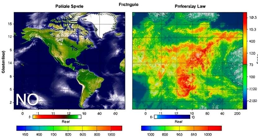
Resolution and Accuracy of Satellite Imagery
Satellite imagery resolution refers to the level of detail captured in an image, often measured in meters per pixel. Higher resolution images have more clarity and allow for more precise mapping and analysis. This is crucial for applications such as urban planning, agriculture monitoring, and disaster response, where accurate information is essential.
Accuracy in satellite imagery is the degree to which the image represents the true characteristics of the Earth’s surface. Factors like sensor calibration, atmospheric conditions, and geometric distortions can affect the accuracy of satellite images. To enhance accuracy, satellite data is often corrected using ground control points and other reference data sources to ensure reliable mapping and analysis outcomes.
• Satellite imagery resolution is measured in meters per pixel
• Higher resolution images provide more clarity and precise mapping capabilities
• Crucial for applications like urban planning, agriculture monitoring, and disaster response
• Accuracy in satellite imagery refers to how well the image represents Earth’s surface characteristics
• Factors like sensor calibration, atmospheric conditions, and geometric distortions can impact accuracy
• Satellite data is often corrected using ground control points and reference data sources for reliable mapping outcomes
Applications of Satellite Imagery in Mapping

Satellite imagery plays a crucial role in mapping various aspects of the Earth’s surface. From urban planning and land use evaluations to environmental monitoring and disaster response, the applications of satellite imagery in mapping are diverse and far-reaching. By utilizing data captured by satellites, experts can accurately assess changes in landscapes, monitor natural resources, and track the effects of climate change over time.
Moreover, satellite imagery is instrumental in precision agriculture by providing detailed information about crop health, soil moisture levels, and pest infestations. Farmers can make informed decisions about irrigation schedules, fertilizer applications, and crop management practices by analyzing satellite data. This technology not only increases agricultural productivity but also minimizes environmental impact through targeted and efficient farming practices.
• Satellite imagery is used in urban planning and land use evaluations
• It helps in environmental monitoring and disaster response
• Experts can accurately assess changes in landscapes using satellite data
• Satellite imagery is crucial for tracking the effects of climate change over time
Furthermore, satellite imagery plays a key role in precision agriculture by:
• Providing detailed information about crop health
• Monitoring soil moisture levels
• Identifying pest infestations
• Allowing farmers to make informed decisions about irrigation schedules, fertilizer applications, and crop management practices
Remote Sensing Techniques in Satellite Imaging
Remote sensing techniques in satellite imaging play a crucial role in gathering information about the Earth’s surface from a distance. Satellite sensors utilize various wavelengths of light to capture images of the planet, enabling scientists and researchers to monitor changes in land use, vegetation cover, and natural disasters. By analyzing these images, experts can assess environmental changes, track urban growth, and study the impacts of climate change on different regions.
Different types of sensors are used in satellite imaging to capture data with varying levels of resolution and accuracy. Optical sensors capture visible and infrared light to produce high-resolution images, while radar sensors can penetrate clouds and provide information about Earth’s surface regardless of weather conditions. Additionally, thermal sensors detect heat emissions from the surface, aiding in monitoring volcanic activity, wildfires, and urban heat islands. Through the integration of data obtained from these diverse sensors, satellite imagery continues to revolutionize our understanding of the world and support a wide range of applications, from agriculture and disaster response to conservation and urban planning.
• Optical sensors capture visible and infrared light for high-resolution images
• Radar sensors can penetrate clouds to provide data regardless of weather conditions
• Thermal sensors detect heat emissions from the surface for monitoring volcanic activity, wildfires, and urban heat islands
• Integration of data from diverse sensors revolutionizes understanding of the world
• Satellite imagery supports applications in agriculture, disaster response, conservation, and urban planning
Challenges in Processing Satellite Data
One of the key challenges in processing satellite data is the sheer volume of information that these satellites collect. With the advancement of technology, satellites can now capture data at a high frequency and resolution, leading to massive datasets that need to be processed efficiently. This requires sophisticated algorithms and computing power to sift through the data and extract meaningful information.
Another obstacle in processing satellite data is ensuring the accuracy and quality of the images collected. Factors such as atmospheric conditions, cloud cover, and sensor calibration can introduce errors or inconsistencies in the data. Processing techniques must account for these variables to produce reliable and precise results. Additionally, the vast amount of data collected from various sensors on different satellites poses a challenge in standardizing and integrating the information for comprehensive analysis and interpretation.
• The sheer volume of information collected by satellites requires sophisticated algorithms and computing power
• Ensuring accuracy and quality of images is a challenge due to factors like atmospheric conditions and sensor calibration
• Standardizing and integrating data from various sensors on different satellites for comprehensive analysis poses difficulties
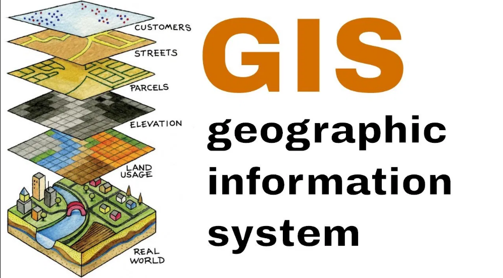
Integration of Satellite Imagery with Geographic Information Systems (GIS)
Satellite imagery plays a vital role in enhancing the capabilities of Geographic Information Systems (GIS) by providing high-resolution data of Earth’s surface. By integrating satellite imagery with GIS, users can visualize, analyze, and interpret spatial information more effectively. This integration enables professionals in various fields such as urban planning, environmental monitoring, disaster management, and agriculture to make informed decisions based on accurate and up-to-date satellite data.
The seamless integration of satellite imagery with GIS also allows for the creation of detailed maps and models that can be used for various applications. From tracking land use changes to monitoring natural disasters, the combination of satellite imagery and GIS offers a powerful tool for decision-makers to better understand and manage the complex relationships between spatial data and real-world phenomena. By harnessing the capabilities of both satellite technology and GIS, organizations and governments can leverage valuable insights to address challenges and drive sustainable development initiatives.
• Satellite imagery enhances GIS capabilities by providing high-resolution data of Earth’s surface
• Integration allows users to visualize, analyze, and interpret spatial information effectively
• Professionals in urban planning, environmental monitoring, disaster management, and agriculture benefit from accurate satellite data
• Detailed maps and models can be created for various applications through seamless integration
• Combination aids in tracking land use changes, monitoring natural disasters, and making informed decisions
• Organizations and governments can leverage insights to address challenges and drive sustainable development initiatives
Role of Artificial Intelligence in Analyzing Satellite Images
Artificial Intelligence (AI) has revolutionized the analysis of satellite images by enabling automated interpretation of vast amounts of data with speed and precision. Through machine learning algorithms, AI can identify patterns, detect changes, and classify objects in satellite imagery more efficiently than traditional methods. By utilizing AI, researchers and industries can extract valuable insights from satellite data to support various applications such as urban planning, disaster response, and environmental monitoring.
Furthermore, AI plays a crucial role in enhancing the accuracy and reliability of satellite image analysis by reducing human error and standardizing interpretation processes. Machine learning models can be trained to recognize specific features in satellite images, leading to improved classification and mapping capabilities. As AI continues to advance, it is expected to further optimize the utilization of satellite imagery for a wide range of fields, ultimately expanding our understanding of the Earth’s dynamics and facilitating informed decision-making based on reliable data.
• AI enables automated interpretation of vast amounts of satellite image data
• Machine learning algorithms can identify patterns, detect changes, and classify objects in imagery
• Researchers and industries can extract valuable insights for applications like urban planning and disaster response
• AI enhances accuracy and reliability by reducing human error in satellite image analysis
• Machine learning models can be trained to recognize specific features, improving classification capabilities
Environmental Monitoring with Satellite Imagery
Satellite imagery has revolutionized the way we monitor environmental changes across the globe. With the capability to capture detailed images of Earth’s surface from space, satellites provide valuable data for assessing deforestation, tracking changes in land use, and monitoring the health of ecosystems. These images offer a comprehensive view of environmental conditions, enabling researchers and policymakers to make informed decisions to protect our planet.
In addition to monitoring natural habitats and biodiversity, satellite imagery is instrumental in detecting and assessing environmental threats such as oil spills, forest fires, and illegal dumping. By analyzing satellite data, authorities can swiftly respond to these incidents, mitigate their impact, and hold responsible parties accountable. The real-time monitoring capabilities of satellite imagery play a crucial role in safeguarding our environment and promoting sustainable practices for the benefit of current and future generations.
• Satellite imagery provides detailed images of Earth’s surface from space
• Valuable data for assessing deforestation, tracking changes in land use, and monitoring ecosystem health
• Enables researchers and policymakers to make informed decisions to protect the planet
• Instrumental in detecting environmental threats such as oil spills, forest fires, and illegal dumping
• Authorities can swiftly respond to incidents, mitigate their impact, and hold responsible parties accountable
• Real-time monitoring capabilities play a crucial role in safeguarding the environment and promoting sustainable practices
Urban Planning and Development Using Satellite Data
Satellite data has revolutionized urban planning by providing valuable insights into urban development trends, infrastructure planning, and land use patterns. By utilizing satellite imagery, urban planners can accurately monitor changes in urban areas, assess the impact of development projects, and make informed decisions for sustainable urban growth. The high-resolution images captured by satellites enable planners to identify areas for potential development, analyze transportation networks, and address issues related to population density and urban sprawl.
Moreover, satellite data plays a crucial role in disaster risk management and resilience planning for urban areas. By monitoring natural disasters, such as floods, hurricanes, and wildfires, satellite imagery helps urban planners assess vulnerabilities, plan evacuation routes, and allocate resources effectively during emergencies. Additionally, satellite data facilitates the mapping of critical infrastructure, such as hospitals, schools, and utilities, which is essential for urban development planning and emergency response preparedness.
• Satellite data provides valuable insights into urban development trends
• Helps in infrastructure planning and monitoring land use patterns
• Enables accurate monitoring of changes in urban areas
• Assists in assessing the impact of development projects
• Facilitates informed decisions for sustainable urban growth
Furthermore, satellite data is instrumental in disaster risk management and resilience planning for urban areas. By tracking natural disasters like floods, hurricanes, and wildfires, satellite imagery aids urban planners in evaluating vulnerabilities, establishing evacuation routes, and efficiently allocating resources during emergencies. Moreover, satellite data assists in mapping critical infrastructure such as hospitals, schools, and utilities – crucial for both urban development planning and emergency response preparedness.
In conclusion, the utilization of satellite data has significantly enhanced the field of urban planning by providing comprehensive information on various aspects of city development. From identifying potential areas for growth to managing disaster risks effectively – satellites have become an indispensable tool for creating sustainable and resilient cities around the world.
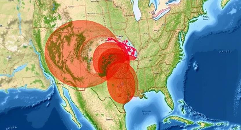
Disaster Response and Management with Satellite Imagery
Satellite imagery has revolutionized disaster response and management by providing real-time information and comprehensive views of affected areas. In times of natural disasters such as hurricanes, earthquakes, or wildfires, satellite images play a crucial role in assessing the extent of damage, identifying areas in need of immediate assistance, and coordinating rescue operations efficiently. With the ability to capture high-resolution images from space, satellites offer invaluable support to emergency response teams in making informed decisions and prioritizing resources effectively.
The detailed remote sensing capabilities of satellites enable rapid damage assessment, monitoring of disaster progression, and evaluation of the impact on critical infrastructure. By overlaying satellite images with geographic information systems (GIS) data, emergency responders can create detailed maps that highlight affected regions, population density, and potential hazards. Moreover, the integration of artificial intelligence algorithms with satellite imagery allows for the automatic detection of damaged buildings, roads, and other key assets, expediting the assessment process and optimizing the allocation of resources for effective disaster management.
• Satellite imagery provides real-time information and comprehensive views of affected areas
• Helps in assessing the extent of damage during natural disasters like hurricanes, earthquakes, or wildfires
• Identifies areas in need of immediate assistance and coordinates rescue operations efficiently
• Captures high-resolution images from space to support emergency response teams in making informed decisions
The detailed remote sensing capabilities of satellites enable:
• Rapid damage assessment
• Monitoring disaster progression
• Evaluation of impact on critical infrastructure
By overlaying satellite images with GIS data, emergency responders can:
• Create detailed maps highlighting affected regions, population density, and potential hazards
• Integrate artificial intelligence algorithms for automatic detection of damaged buildings and roads
Mapping Natural Resources with Satellite Data
Satellite data plays a crucial role in mapping natural resources, enabling researchers and policymakers to monitor and manage Earth’s valuable assets from a bird’s eye view. Through the use of advanced satellite sensors, such as multispectral and hyperspectral imaging devices, experts can accurately identify different types of resources like forests, water bodies, minerals, and agricultural land. These sensors capture detailed information about the Earth’s surface, allowing for the creation of high-resolution maps that support sustainable resource management practices.
Furthermore, the integration of satellite imagery with Geographic Information Systems (GIS) enhances the analysis of natural resources by providing spatial context and enabling users to overlay various layers of data. This spatial analysis capabilities allow for better decision-making in areas such as land use planning, conservation efforts, and resource extraction. By leveraging the power of satellite data, stakeholders can gain valuable insights into the distribution, quantity, and quality of natural resources, leading to more informed and effective resource management strategies.
• Satellite data provides a bird’s eye view of Earth’s natural resources
• Advanced sensors like multispectral and hyperspectral imaging devices help identify different types of resources
• High-resolution maps created from satellite data support sustainable resource management practices
• Integration with GIS enhances analysis by providing spatial context
• Spatial analysis capabilities enable better decision-making in land use planning, conservation efforts, and resource extraction
Tracking Climate Change through Satellite Observations
Satellites have become powerful tools in monitoring and tracking the effects of climate change on our planet. By capturing detailed images of Earth’s surface and atmosphere from space, satellites provide scientists with valuable data for studying temperature variations, sea level rise, glacial melting, deforestation, and other indicators of environmental change. These observations help researchers to understand the impact of human activities on the environment and contribute to the development of effective strategies for mitigating climate change.
The use of satellite observations in tracking climate change offers a global perspective that is essential for assessing how different regions are being affected by shifts in weather patterns and rising temperatures. With satellites constantly collecting data from various parts of the world, scientists can analyze trends over time and make projections about future climate scenarios. This information is crucial for policymakers, environmental agencies, and communities to take proactive measures in adapting to the challenges posed by climate change.
• Satellites provide detailed images of Earth’s surface and atmosphere
• Data from satellites help study temperature variations, sea level rise, glacial melting, deforestation, and more
• Satellite observations aid in understanding the impact of human activities on the environment
• Global perspective offered by satellite data helps assess regional effects of climate change
• Continuous data collection allows for trend analysis and future climate projections
The Role of Satellites in Precision Agriculture
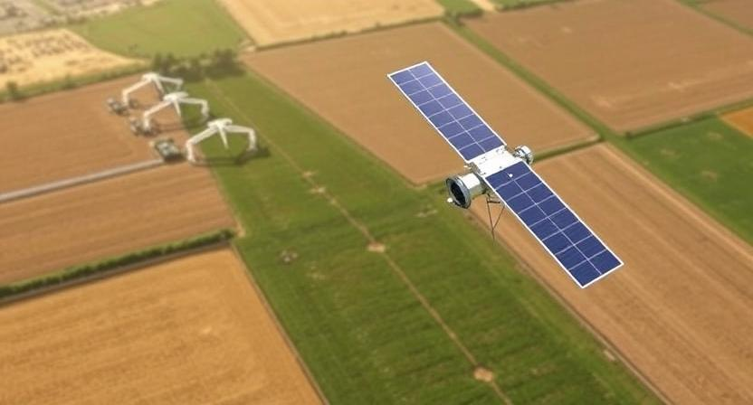
Precision agriculture relies heavily on the use of satellite technology to optimize farming practices. Satellites equipped with advanced sensors can capture detailed images of agricultural fields, allowing farmers to monitor crop health, detect pest infestations, and assess soil conditions with precision. By analyzing satellite imagery, farmers can make informed decisions regarding irrigation, fertilization, and pest control, leading to increased crop yields and cost savings.
Moreover, satellite data can be integrated with other technologies such as GPS and drones to create detailed maps of farmland. These maps enable farmers to create customized treatment plans for different areas within their fields, tailoring interventions based on specific crop requirements. This targeted approach not only improves the efficiency of farming operations but also reduces the environmental impact by minimizing the use of resources like water and chemicals.
– Satellite technology provides detailed images of agricultural fields
– Farmers can monitor crop health, detect pest infestations, and assess soil conditions with precision
– Analysis of satellite imagery helps farmers make informed decisions on irrigation, fertilization, and pest control
– Integration of satellite data with GPS and drones allows for creation of detailed maps of farmland
– Customized treatment plans can be developed based on specific crop requirements within different areas of the fields
Military and Defense Applications of Satellite Imagery
Satellite imagery plays a crucial role in military and defense applications, providing valuable intelligence and surveillance capabilities. By leveraging satellite data, military forces can acquire real-time information on enemy movements, monitor critical infrastructure, and assess potential threats in various regions across the globe. The high-resolution images captured by satellites enable military strategists to plan and execute operations with precision and efficiency, enhancing situational awareness on the battlefield.
Additionally, satellite imagery serves as a vital tool for monitoring troop movements, verifying compliance with international treaties, and conducting reconnaissance missions in remote or hostile environments. The ability to access satellite data offers military commanders a distinct advantage in assessing the landscape, identifying potential obstacles or vulnerabilities, and making informed decisions to safeguard national security interests. With advancements in satellite technology, military and defense agencies can maintain a strategic edge by leveraging satellite imagery for reconnaissance, surveillance, and intelligence gathering purposes.
• Satellite imagery provides real-time information on enemy movements
• Helps in monitoring critical infrastructure and assessing potential threats
• High-resolution images enable precise planning and execution of military operations
• Vital tool for monitoring troop movements, verifying compliance with international treaties, and conducting reconnaissance missions in remote or hostile environments
• Access to satellite data offers military commanders a distinct advantage in safeguarding national security interests
• Advancements in satellite technology help maintain a strategic edge by leveraging satellite imagery for reconnaissance, surveillance, and intelligence gathering purposes.
Privacy Concerns Related to Satellite Surveillance
Privacy concerns related to satellite surveillance have become a significant issue in recent years. With the advancement of satellite technology, the ability to capture high-resolution images from space has raised questions about the intrusion of privacy. Individuals and organizations are worried about the potential misuse of satellite imagery for monitoring and tracking activities without consent.
The widespread availability of satellite images accessible to the public has sparked debates about the balance between security and privacy. Concerns range from the tracking of individuals’ movements to the monitoring of private property without permission. As the capabilities of satellite technology continue to improve, ensuring the protection of privacy rights remains a complex challenge that requires careful consideration and regulation.
• The advancement of satellite technology has raised concerns about the intrusion of privacy
• Individuals and organizations are worried about potential misuse of satellite imagery for monitoring activities without consent
• Debates have sparked regarding the balance between security and privacy with widespread availability of satellite images accessible to the public
• Concerns include tracking individuals’ movements and monitoring private property without permission
• Protection of privacy rights in relation to satellite surveillance remains a complex challenge that requires careful consideration and regulation
Future Trends in Satellite Mapping Technology
The future of satellite mapping technology holds exciting possibilities as advancements continue to push boundaries. One key trend on the horizon is the development of next-generation satellites equipped with even higher resolution sensors, providing more detailed and precise imagery of the Earth’s surface. These improved satellites will enable more accurate mapping, monitoring, and analysis across various sectors such as urban planning, agriculture, disaster management, and environmental conservation.
Another prominent trend is the integration of satellite mapping technology with artificial intelligence (AI) algorithms to automate and optimize image analysis processes. AI-based systems can handle vast amounts of satellite data more efficiently, extracting valuable insights and patterns at a speed unmatched by manual methods. This symbiosis between satellite mapping technology and AI is expected to revolutionize how we interpret and utilize satellite imagery for a wide range of applications in the coming years.
• Next-generation satellites with higher resolution sensors
• More detailed and precise imagery for accurate mapping and monitoring
• Applications in urban planning, agriculture, disaster management, and environmental conservation
• Integration of satellite mapping technology with artificial intelligence (AI) algorithms
• Automation and optimization of image analysis processes
• Efficient extraction of insights and patterns from vast amounts of data
• Revolutionizing interpretation and utilization of satellite imagery across various applications
Collaboration between Countries in Sharing Satellite Data
Collaboration between countries in sharing satellite data plays a crucial role in enhancing global monitoring capabilities and promoting international cooperation in various fields. Through the exchange of satellite data, countries can benefit from accessing a diverse range of information that aids in better understanding and managing environmental changes, disaster responses, and territorial monitoring. This collaboration fosters transparency and fosters mutual trust among nations, leading to more effective decision-making processes based on reliable and up-to-date satellite imagery.
Moreover, sharing satellite data between countries enables the pooling of resources and expertise, resulting in cost-effective solutions for addressing common challenges such as natural disasters, climate change, and environmental conservation. By working together to share and analyze satellite data, countries can leverage each other’s strengths and knowledge to develop innovative solutions that benefit not only individual nations but also the global community as a whole. This collaborative approach showcases the power of satellite technology in promoting peace, security, and sustainable development across borders.
• Collaboration between countries in sharing satellite data enhances global monitoring capabilities
• Promotes international cooperation in various fields
• Access to diverse information aids in understanding and managing environmental changes, disaster responses, and territorial monitoring
• Fosters transparency and mutual trust among nations for effective decision-making processes
Moreover, sharing satellite data between countries enables:
• Pooling of resources and expertise for cost-effective solutions
• Addressing common challenges such as natural disasters, climate change, and environmental conservation
• Leveraging strengths and knowledge to develop innovative solutions benefiting individual nations and the global community
• Showcasing the power of satellite technology in promoting peace, security, and sustainable development across borders.