
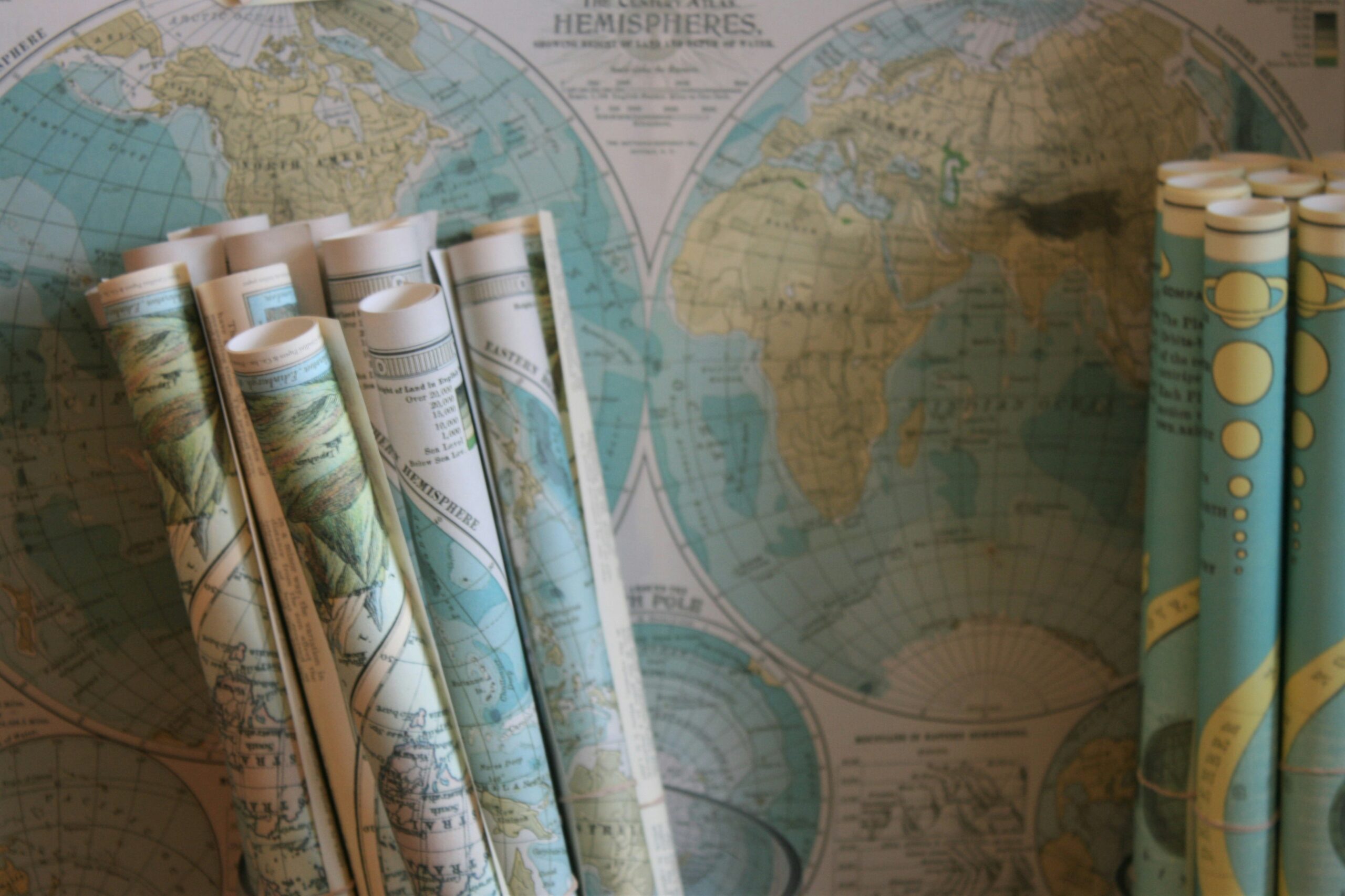
Early Use of Maps in Exploration
Maps have been instrumental in shaping the course of exploration throughout history. Long before the age of satellite navigation and GPS, early explorers relied on rudimentary maps to navigate the uncharted territories. These early maps, often crude in their depictions, provided explorers with a sense of direction and helped them plan their journeys into the unknown.
Early civilizations such as the Greeks, Romans, and Chinese all developed their own mapping techniques to aid in exploration. These ancient maps served not only as navigational tools but also as symbols of power and knowledge. By mapping out new lands and territories, early explorers were able to expand their empires and establish trade routes that connected distant lands.
• Maps have played a crucial role in shaping exploration throughout history
• Early explorers relied on rudimentary maps for navigation
• Ancient civilizations like the Greeks, Romans, and Chinese developed their own mapping techniques
• Maps were not only used for navigation but also as symbols of power and knowledge
• Mapping out new lands helped expand empires and establish trade routes
Ancient Mapping Techniques
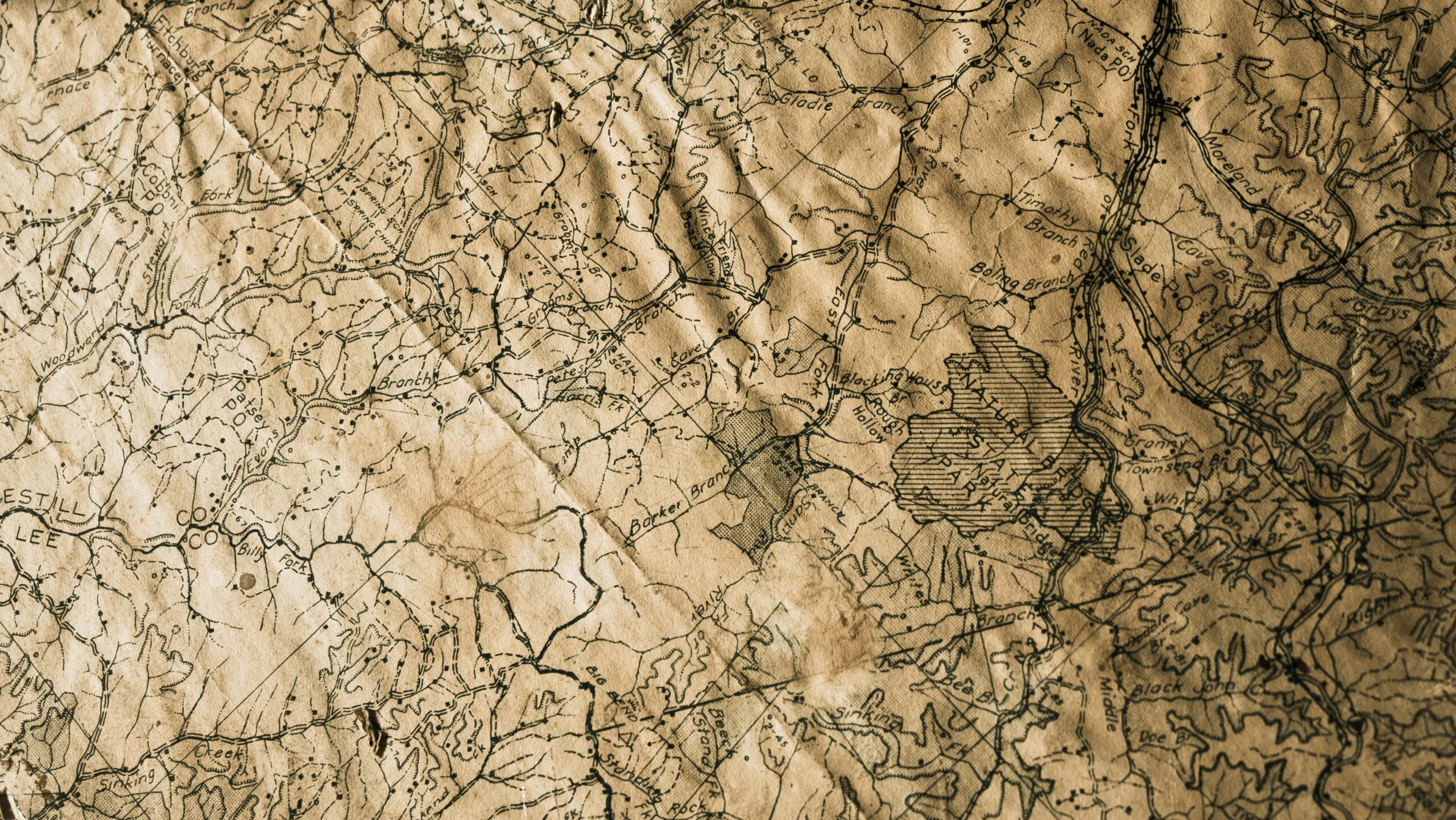
Ancient civilizations utilized diverse methods to create maps for navigation and exploration. One common technique involved creating maps on clay tablets or papyrus using intricate sketches and symbols to represent different landmarks and regions. These early maps were essential for guiding travelers and traders across vast distances by land or sea. Additionally, ancient cartographers often relied on celestial observations and geometric measurements to determine the layout of the land and create accurate representations on their maps.
Furthermore, ancient mapping techniques were also characterized by the use of oral traditions and storytelling to pass down geographical knowledge from generation to generation. In some cultures, maps were inscribed on rock surfaces or tree barks to serve as permanent markers of important locations or boundaries. The art of mapmaking in ancient times not only facilitated exploration and trade but also played a crucial role in preserving historical and cultural legacies through visual representations of the world around them.
• Ancient civilizations created maps on clay tablets or papyrus with sketches and symbols
• Maps were crucial for guiding travelers and traders across vast distances by land or sea
• Cartographers used celestial observations and geometric measurements to create accurate representations
• Oral traditions and storytelling were used to pass down geographical knowledge through generations
• Some cultures inscribed maps on rock surfaces or tree barks as permanent markers of important locations
Impact of Cartography on Exploration
Maps have played a crucial role in the history of exploration. By providing a visual representation of the world, cartography has enabled explorers to plan their expeditions more effectively and navigate through unfamiliar territories with greater confidence. Without accurate maps, many significant voyages of discovery may not have been possible, as explorers relied on them to chart new routes and navigate treacherous waters.
Furthermore, the impact of cartography on exploration goes beyond simply aiding in navigation. Maps also served as tools for communication and knowledge sharing among explorers, helping them to document their findings and contribute to the collective understanding of the world. This sharing of information facilitated the exchange of ideas and discoveries between different cultures and civilizations, ultimately leading to a more interconnected and globalized world.
• Cartography has been instrumental in enabling explorers to plan expeditions effectively
• Maps have helped explorers navigate through unfamiliar territories with confidence
• Without accurate maps, many significant voyages of discovery may not have been possible
• Maps served as tools for communication and knowledge sharing among explorers
• Sharing information facilitated the exchange of ideas and discoveries between different cultures
• Ultimately led to a more interconnected and globalized world
Role of Maps in Navigation
Maps have played a crucial role in navigation for centuries. By providing a visual representation of the world, maps have enabled sailors, explorers, and travelers to plot their courses and chart their journeys across the seas. Without accurate maps, navigation would have been much more challenging and treacherous, making it difficult to reach new destinations and explore unknown territories.
Throughout history, maps have been used to navigate vast oceans, treacherous mountain ranges, and expansive deserts. By referencing landmarks, coastlines, and geographical features on maps, navigators were able to determine their positions and navigate with greater precision. Maps have served as indispensable tools for sailors, guiding them safely to their destinations and helping them avoid dangerous obstacles along the way.
• Maps provide a visual representation of the world
• Enables sailors, explorers, and travelers to plot courses
• Helps navigate across oceans, mountains, and deserts
• Reference landmarks and coastlines for position determination
• Indispensable tools for sailors to reach destinations safely
Development of Mapmaking Tools
Mapmaking tools have evolved significantly throughout history, with early civilizations relying on rudimentary instruments like compasses and straight edges to create basic maps. Over time, advancements in technology and understanding have led to the development of more sophisticated tools, such as astrolabes and sextants, which improved the accuracy and detail of maps. These tools were crucial for early explorers and cartographers as they ventured into unknown territories, helping them chart new lands and navigate treacherous waters with greater precision.
The invention of the printing press in the 15th century revolutionized mapmaking, enabling the mass production of maps and expanding their accessibility to a wider audience. This innovation, coupled with the use of more precise instruments like the theodolite and magnetic compass, paved the way for the creation of detailed and reliable maps that played a vital role in shaping the course of exploration and conquest. As mapmaking tools continued to advance, explorers were able to venture further than ever before, uncovering new lands and expanding the known boundaries of the world.
• The use of compasses and straight edges in early civilizations
• Advancements in technology leading to tools like astrolabes and sextants
• Importance of accurate maps for explorers and cartographers
• Impact of the printing press on mapmaking in the 15th century
• Role of instruments like the theodolite and magnetic compass in improving map accuracy
• Expansion of known boundaries through advancements in mapmaking tools
Influence of Maps on Trade Routes
Maps have played a crucial role in shaping trade routes throughout history. By providing a visual representation of geographical features, maps have allowed traders to plan and navigate their journeys more effectively. With the aid of maps, traders could identify the shortest and safest routes, avoiding natural obstacles such as mountains, deserts, or rough terrain.
Moreover, maps have facilitated the expansion of trade networks by highlighting key locations for commerce such as ports, rivers, and strategic crossroads. This information enabled traders to connect different regions and civilizations, fostering economic exchanges and cultural interactions. As a result, maps have not only influenced the efficiency of trade routes but also contributed to the growth and interconnectedness of global trade systems.
• Maps provide a visual representation of geographical features
• Traders can identify shortest and safest routes with the help of maps
• Maps highlight key locations for commerce such as ports, rivers, and strategic crossroads
• Trade networks have expanded due to information provided by maps
• Global trade systems have grown and become more interconnected thanks to maps
Maps as Tools for Conquest
Maps have been indispensable tools for conquest throughout history, aiding military leaders in strategizing and executing their campaigns. By providing a comprehensive overview of terrain, resources, and potential obstacles, maps have allowed conquerors to plan their movements effectively and exploit their enemies’ vulnerabilities. Whether in ancient times or during the Age of Exploration, maps played a crucial role in shaping the outcome of conquests, enabling conquerors to assert their dominance over new territories.
The use of maps in conquest not only facilitated the expansion of empires but also served as a means of asserting power and control over conquered lands. Conquerors utilized detailed maps to establish administrative boundaries, allocate resources, and enforce their authority over indigenous populations. Maps became symbols of conquest, showcasing the territorial extent of empires and reinforcing the conquerors’ perceived superiority over the conquered peoples. In this way, maps not only facilitated conquest but also played a fundamental role in legitimizing and perpetuating imperial rule.
• Maps provide a comprehensive overview of terrain, resources, and potential obstacles
• Conquerors use maps to plan movements effectively and exploit enemies’ vulnerabilities
• Maps played a crucial role in shaping the outcome of conquests throughout history
• Detailed maps were used to establish administrative boundaries and enforce authority over conquered lands
• Maps became symbols of conquest, showcasing territorial extent of empires
Use of Maps in Discovering New Lands
Maps have played a crucial role in the exploration and discovery of new lands throughout history. By providing explorers with a visual representation of the world, maps have guided them towards uncharted territories and helped them navigate unfamiliar landscapes. These maps, often hand-drawn and displaying limited geographical information, served as invaluable tools for early explorers seeking to expand their knowledge of the world.
During the Age of Discovery, maps became even more sophisticated and accurate, thanks to advancements in cartography and increased exploration efforts. Explorers like Christopher Columbus used detailed maps to plan their journeys to the New World, relying on these visual aids to chart their course across vast oceans. Without the guidance of maps, many of these historic voyages of discovery would have been much riskier and more uncertain, highlighting the significant role that maps have played in shaping the course of history through the exploration of new lands.
• Maps provide explorers with a visual representation of the world
• Hand-drawn maps with limited information were used by early explorers
• Maps became more sophisticated during the Age of Discovery
• Christopher Columbus and other explorers relied on detailed maps to plan their journeys
• Without maps, historic voyages of discovery would have been riskier and more uncertain
Mapping Expeditions in History
Explorers throughout history have embarked on mapping expeditions to uncover and document the unknown regions of the world. These daring ventures were essential for not only expanding geographical knowledge but also for establishing trade routes and claiming new territories. Mapping expeditions often involved meticulous surveying, sketching, and charting of landscapes, coastlines, and other geographical features to create accurate maps that could guide future explorations.
Famous expeditions such as those led by James Cook in the 18th century and Lewis and Clark in the early 19th century played pivotal roles in mapping uncharted territories in North America. These expeditions not only provided valuable information about the landforms, flora, and fauna of the regions they explored but also paved the way for the colonization and development of new lands. Mapping expeditions in history have been instrumental in shaping our understanding of the world and continue to inspire modern explorers to push the boundaries of geographical knowledge.
• Mapping expeditions have been crucial for expanding geographical knowledge
• These ventures involved surveying, sketching, and charting landscapes and coastlines
• Famous expeditions like those led by James Cook and Lewis and Clark mapped uncharted territories in North America
• Information from these expeditions helped in colonization and development of new lands
• Mapping expeditions continue to inspire modern explorers to explore unknown regions
Maps and Colonial Expansion
Maps played a crucial role in the colonial expansion of European powers during the Age of Exploration. By utilizing accurate maps, explorers were able to navigate previously uncharted territories with more efficiency and confidence. These maps provided valuable information on landforms, waterways, and potential resources, enabling colonizers to claim and exploit new lands.
The detailed maps produced during this period also facilitated the establishment of trade routes and the expansion of global commerce. With the aid of maps, traders could navigate distant seas and chart more direct paths to lucrative markets. As a result, maps not only served as tools for conquest but also as vehicles for economic growth and the extension of imperial power.
• Maps were essential tools for European explorers during the Age of Exploration
• Accurate maps allowed for more efficient navigation of uncharted territories
• Detailed maps helped establish trade routes and expand global commerce
• Maps played a crucial role in both conquest and economic growth during colonial expansion
Cartographic Innovations in Exploration
Cartographic innovations have played a crucial role in shaping the course of exploration throughout history. With the advancements in technology and techniques, mapmakers were able to create more accurate and detailed maps that enabled explorers to navigate uncharted territories with greater precision. The invention of the compass and the astrolabe revolutionized navigation, allowing sailors to determine their position at sea more effectively.
Additionally, the development of printing techniques in the 15th century made it possible to produce maps in larger quantities, which were instrumental in disseminating geographical knowledge and inspiring further expeditions. The creation of portolan charts, showing coastlines and harbors, facilitated safer maritime travels and encouraged explorers to venture beyond the known world in search of new lands and trading routes.
• The invention of the compass and astrolabe revolutionized navigation
• Printing techniques in the 15th century allowed for mass production of maps
• Portolan charts showing coastlines and harbors made maritime travels safer
• Cartographic innovations inspired further expeditions beyond the known world
Maps and the Age of Discovery
During the Age of Discovery, maps played a pivotal role in shaping the course of exploration and navigation across unknown seas. These maps, although often imperfect and lacking in accuracy by modern standards, provided early explorers with a sense of direction and a reference point for charting their journeys into uncharted territories. Without the aid of these maps, many of the significant voyages of discovery, such as those led by Columbus, Magellan, and Vasco da Gama, may not have been possible.
The development of more advanced cartographic techniques during the Age of Discovery, such as the use of latitude and longitude lines, significantly improved the accuracy of maps and navigation. This progress enabled explorers to traverse greater distances with more confidence, leading to the discovery of new trade routes, lands, and cultures. Maps became invaluable tools for sailors and explorers, guiding them safely across treacherous waters and unfamiliar terrain in their quest for new discoveries and conquests.
• Maps were essential tools for early explorers during the Age of Discovery
• Imperfect and lacking in accuracy by modern standards, maps provided a sense of direction for explorers
• Significant voyages of discovery, such as those led by Columbus, Magellan, and Vasco da Gama, may not have been possible without maps
• Advanced cartographic techniques like latitude and longitude lines improved map accuracy and navigation during this time
• Improved maps enabled explorers to traverse greater distances with more confidence
• The discovery of new trade routes, lands, and cultures was made possible due to advancements in mapping during the Age of Discovery
Exploration of the New World with Maps
Maps played a crucial role in the exploration of the New World, allowing early explorers to navigate vast and unknown territories with a level of precision previously unimaginable. Cartographers meticulously charted coastlines, rivers, and landmarks, providing a valuable tool for sailors to traverse the seas and reach new lands. With the aid of these maps, explorers such as Christopher Columbus, Vasco da Gama, and Ferdinand Magellan were able to complete their daring voyages and make significant discoveries that would shape the course of history.
The detailed maps of the New World not only facilitated navigation but also fueled the ambitions of European powers seeking to establish colonies and expand their territories. The accurate depiction of geographical features enabled conquerors to strategically plan their conquests and exploit the resources of these newfound lands. Maps became indispensable tools for both exploration and conquest, driving the age of discovery and paving the way for the rise of powerful empires in the Americas.
• Maps provided early explorers with a level of precision previously unimaginable
• Cartographers meticulously charted coastlines, rivers, and landmarks
• Valuable tool for sailors to traverse the seas and reach new lands
• Explorers like Christopher Columbus, Vasco da Gama, and Ferdinand Magellan used maps to complete daring voyages
The detailed maps of the New World not only facilitated navigation but also fueled the ambitions of European powers seeking to establish colonies and expand their territories. The accurate depiction of geographical features enabled conquerors to strategically plan their conquests and exploit the resources of these newfound lands. Maps became indispensable tools for both exploration and conquest, driving the age of discovery and paving the way for the rise of powerful empires in the Americas.
• Accurate depiction allowed conquerors to strategically plan conquests
• Maps were crucial in exploiting resources of newly discovered lands
• Indispensable tools for exploration as well as conquest
• Paved way for rise of powerful empires in Americas
Mapping the Silk Road
Tracing its origins back to the Han Dynasty in China, the Silk Road was a network of trade routes that connected the East and West, facilitating the exchange of goods, ideas, and culture. This ancient route spanned over 6,000 kilometers, crossing vast deserts, mountains, and grasslands, making it a challenging path for merchants and travelers alike.
The mapping of the Silk Road was crucial for merchants to navigate and plan their journeys effectively. Early maps depicted the key cities, oases, and geographical features along the route, providing valuable information on where to find resources and safe passage. These maps not only guided traders but also influenced the expansion of empires, the spread of religions, and the exchange of knowledge between different civilizations.
• The Silk Road was a network of trade routes connecting the East and West
• Tracing back to the Han Dynasty in China, it spanned over 6,000 kilometers
• It crossed vast deserts, mountains, and grasslands making it challenging for travelers
Mapping the Silk Road was essential for navigation and planning:
• Early maps depicted key cities, oases, and geographical features along the route
• Provided valuable information for finding resources and safe passage
• Guided traders and influenced empires’ expansion, spread of religions, and knowledge exchange
Importance of Maps in Sea Voyages
Maps have played a crucial role in sea voyages throughout history. Navigating the vast and often treacherous oceans required sailors to rely on accurate maps to plot their course and avoid getting lost at sea. Without maps, sailors risked sailing into unknown territories, facing the dangers of unpredictable weather conditions and uncharted waters.
By using maps, sailors could identify landmarks, coastlines, and navigational markers to guide their ships safely to their destinations. Maps not only provided a sense of direction but also helped sailors estimate distances and plan their voyages more effectively. With the aid of maps, sailors were able to explore new lands, establish trade routes, and expand their empires across the seas.
• Maps have been essential tools for sailors to navigate the oceans safely
• They help in identifying landmarks, coastlines, and navigational markers
• Maps provide a sense of direction and help estimate distances accurately
• Sailors use maps to explore new lands, establish trade routes, and expand their empires across seas
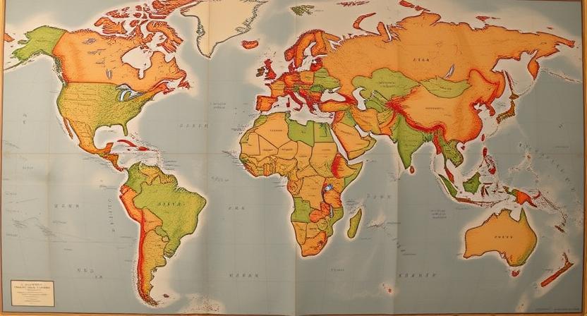
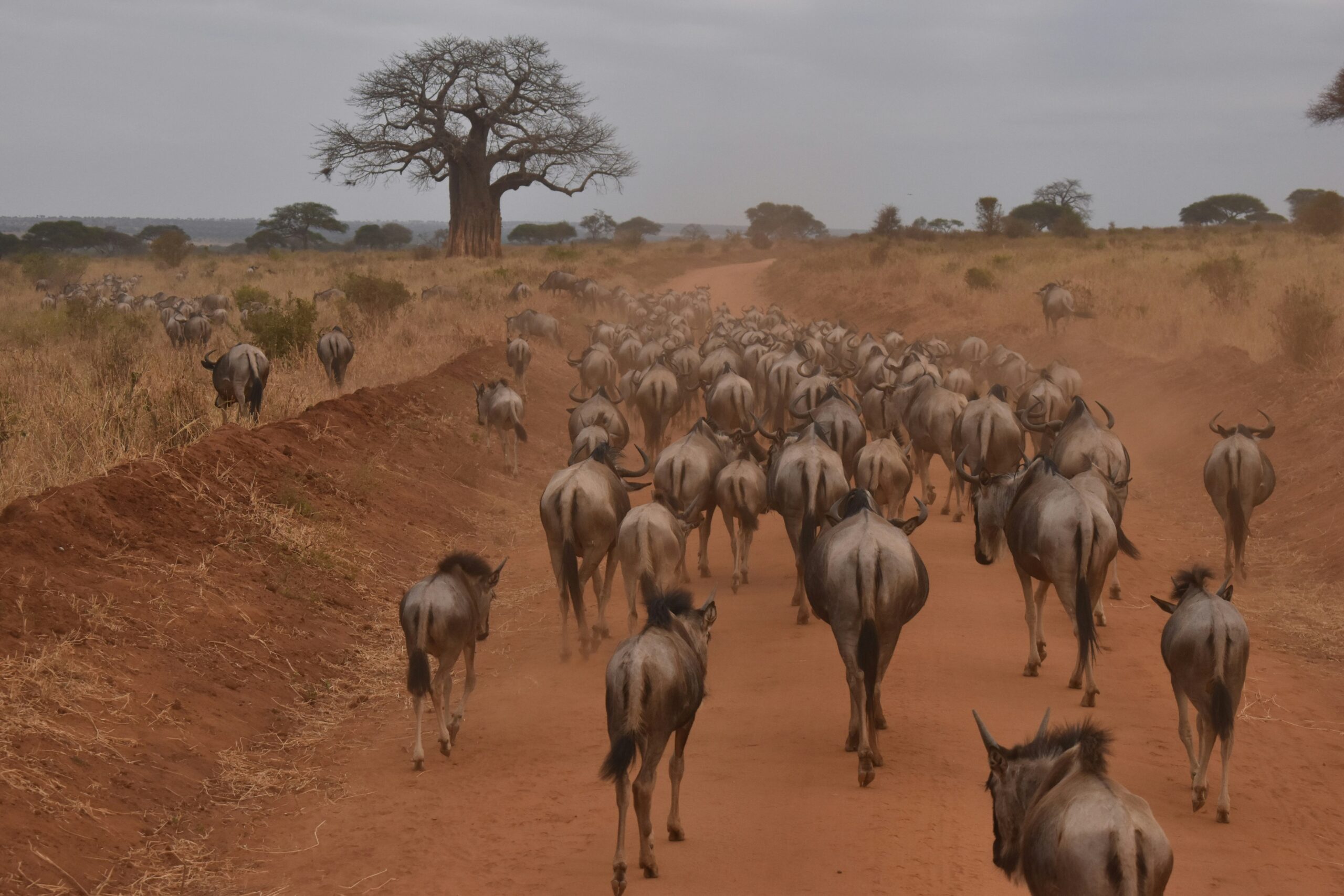
Mapping the African Continent
Maps have played a crucial role in understanding and documenting the vast and diverse landscape of the African continent. From the early hand-drawn maps by European explorers to the more detailed and accurate maps produced in modern times, cartography has contributed significantly to the exploration and colonization of Africa. These maps not only showcased the topography and resources of the continent but also helped in the demarcation of borders and the establishment of trade routes.
One of the significant challenges in mapping the African continent has been the sheer size and complexities of its terrain. With a range of landscapes including deserts, mountains, forests, and savannas, cartographers have had to overcome numerous obstacles to accurately depict the continent on maps. Despite these challenges, the mapping of Africa has been instrumental in understanding its rich history, diverse cultures, and natural resources, shaping the way we perceive and interact with the continent today.
• Mapping the African continent has been crucial in understanding its vast and diverse landscape
• Early hand-drawn maps by European explorers paved the way for more detailed and accurate modern maps
• Cartography has played a significant role in the exploration and colonization of Africa
• Maps have showcased the topography, resources, borders, and trade routes of the continent
• Challenges in mapping Africa include its sheer size and complex terrain with deserts, mountains, forests, and savannas
Influence of Maps on Scientific Expeditions
Maps have played a crucial role in guiding scientific expeditions throughout history. From early explorations to modern-day research missions, maps have provided vital information regarding terrain, coordinates, and environmental features. Scientists rely on accurate maps to plan their expeditions, determine optimal routes, and navigate through unfamiliar territories efficiently.
In the past, expeditions faced immense challenges in mapping uncharted lands and remote regions. However, advancements in cartography have significantly improved the accuracy and detail of maps used in scientific exploration. With the aid of precise maps, scientists can better analyze geological formations, study wildlife habitats, and conduct research in diverse ecosystems with greater precision and effectiveness.
• Maps provide crucial information on terrain, coordinates, and environmental features
• Scientists rely on accurate maps to plan expeditions and navigate through unfamiliar territories efficiently
• Advancements in cartography have improved the accuracy and detail of maps used in scientific exploration
• Precise maps help scientists analyze geological formations, study wildlife habitats, and conduct research with greater precision
Maps and the Spread of Empires
Maps played a crucial role in the expansion of empires throughout history. By accurately documenting territories, trade routes, and resources, maps provided valuable information for empires to strategically plan their conquests. Empires such as the Roman Empire, Ottoman Empire, and British Empire heavily relied on detailed maps to navigate unfamiliar territories and effectively expand their domains.
Furthermore, maps not only facilitated the physical expansion of empires but also helped in the maintenance and administration of conquered lands. Detailed maps of conquered territories allowed empires to establish efficient systems of governance, collect taxes, and enforce laws effectively. The accurate mapping of borders and resources also helped empires in asserting their dominance over rival powers and solidifying their control over vast territories.
• Maps provided valuable information for empires to strategically plan their conquests
• Empires like the Roman Empire, Ottoman Empire, and British Empire heavily relied on detailed maps
• Detailed maps facilitated the physical expansion of empires
• Maps helped in the maintenance and administration of conquered lands
• Accurate mapping of borders and resources helped empires assert dominance over rival powers
Cartography in the Age of Exploration
New advances in cartography played a crucial role in shaping the Age of Exploration. Maps became indispensable tools for adventurers seeking new lands and trade routes. These detailed representations of the world not only guided explorers during their journeys but also sparked curiosity and fascination about the unknown.
Cartographers during this period meticulously documented the discoveries made by explorers, fueling even more expeditions to uncharted territories. The accuracy and intricacy of maps improved significantly, providing valuable information on land formations, coastlines, and navigational routes. As a result, explorers were able to traverse vast distances with more confidence and precision, leading to the opening of new trade routes and the colonization of distant lands.
• Maps became essential tools for adventurers seeking new lands and trade routes
• Cartographers meticulously documented discoveries made by explorers, fueling more expeditions to uncharted territories
• Accuracy and intricacy of maps improved significantly, providing valuable information on land formations, coastlines, and navigational routes
• Explorers were able to traverse vast distances with more confidence and precision
• New trade routes were opened and distant lands were colonized as a result of advancements in cartography during the Age of Exploration.
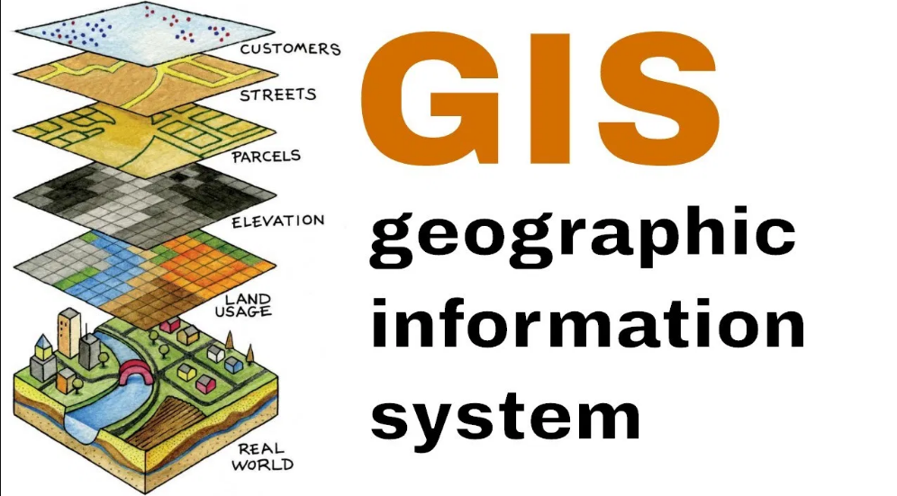
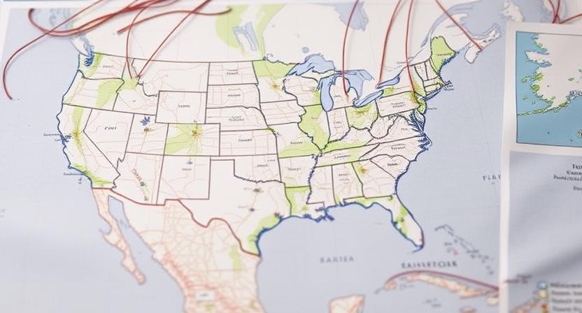
Role of Maps in Modern Historical Research
Maps play a crucial role in modern historical research by providing invaluable insights into past civilizations, territories, and journeys. Historical maps offer researchers a visual representation of how the world was perceived and understood in different time periods, shedding light on trade routes, political boundaries, and cultural exchanges. By analyzing maps from various eras, historians can piece together the puzzle of human history and better comprehend the complexities of interactions between societies.
Furthermore, the digitalization of historical maps has revolutionized the field of historical research, making it easier for scholars to access and analyze a vast array of cartographic resources. Through digitized maps, researchers can overlay different layers of information, compare geographical features over time, and uncover hidden connections that may have been overlooked in traditional paper maps. This enhanced accessibility to historical mapping data has opened up new avenues for exploration and interpretation, allowing historians to delve deeper into the past and enrich their understanding of historical events and processes.
• Maps provide visual representation of past civilizations, territories, and journeys
• Historical maps shed light on trade routes, political boundaries, and cultural exchanges
• Analyzing maps from various eras helps historians piece together human history
• Digitalization of historical maps has revolutionized historical research
• Digitized maps allow for overlaying different layers of information for analysis
• Comparing geographical features over time is easier with digital maps
• Enhanced accessibility to historical mapping data opens up new avenues for exploration
