
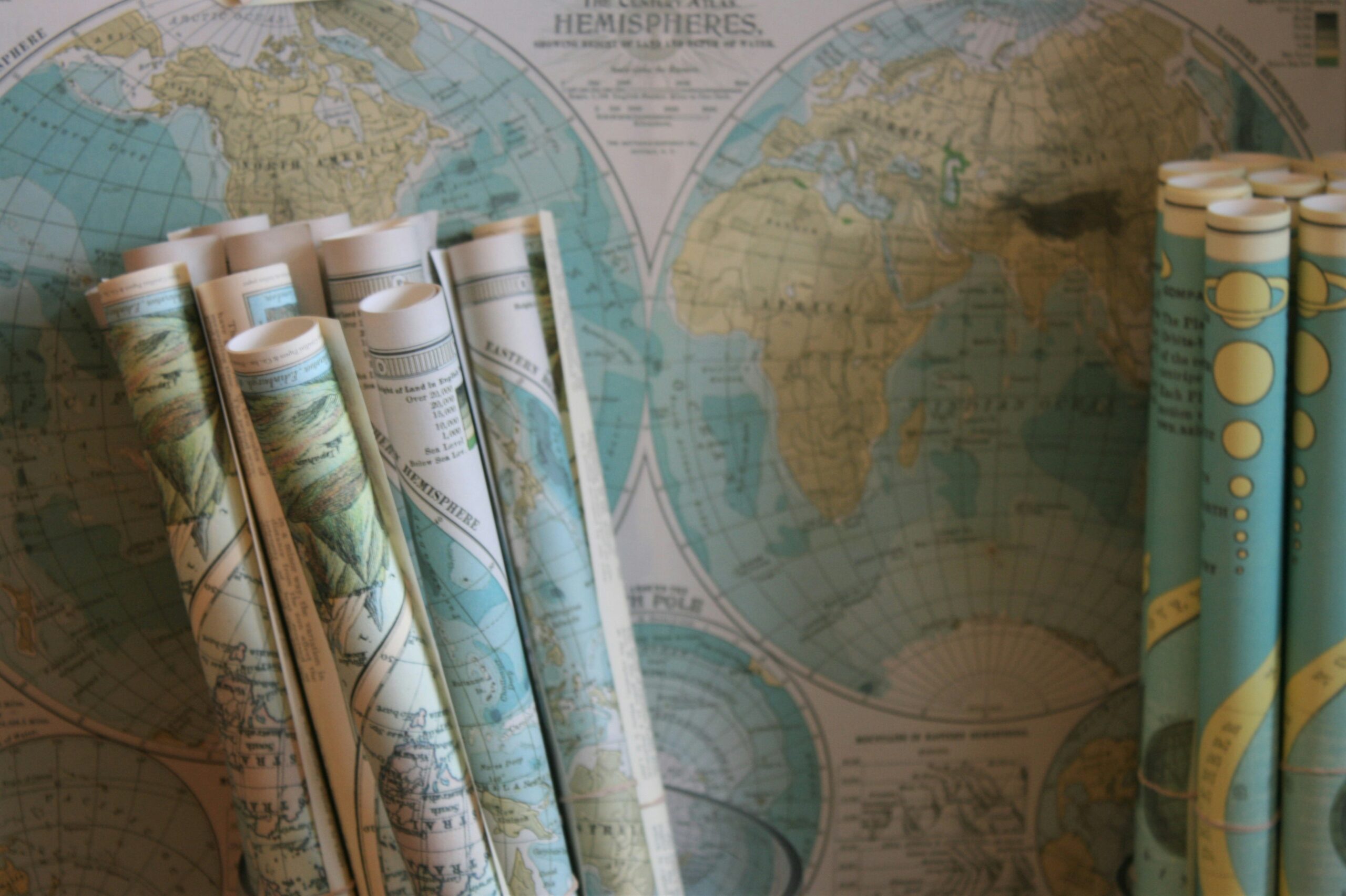
Historical Background of Old Maps
The history of old maps dates back to ancient times when early civilizations sought to represent the world around them. Initially, maps were simplistic and symbolic, reflecting the limited geographical knowledge of the era. As civilizations grew and interacted with one another, the need for more accurate and detailed maps arose. This marked the beginning of a gradual evolution in cartography, as mapmakers endeavored to capture not only the physical landscapes but also the cultural and political nuances of the regions they depicted.
Over the centuries, the techniques and styles of mapmaking underwent significant transformations, influenced by factors such as technological advancements, exploratory voyages, and prevailing worldviews. The development of new tools and instruments, coupled with the emergence of scientific methods, greatly improved the accuracy and reliability of maps. Moreover, as exploration expanded and trade flourished, maps became indispensable tools for navigation, diplomacy, and conquest. The historical background of old maps mirrors the ever-changing tapestry of human knowledge and ambitions, offering insights into the complex interplay of art, science, and power in shaping our understanding of the world.
• Maps were simplistic and symbolic in ancient times
• Need for more accurate and detailed maps arose as civilizations grew
• Evolution in cartography began to capture physical landscapes, cultural, and political nuances
• Techniques and styles of mapmaking transformed over the centuries
• Influenced by technological advancements, exploratory voyages, and prevailing worldviews
• Development of new tools and instruments improved accuracy and reliability of maps
• Maps became indispensable tools for navigation, diplomacy, and conquest due to exploration expansion
Origins of Cartography
Cartography, the art and science of mapmaking, has a rich and intricate history that dates back to ancient civilizations. The origins of cartography can be traced to early human societies that sought to document and navigate their surroundings. Through primitive drawings on rocks, clay tablets, and papyrus, these early mapmakers began to capture the layout of their world and understand the relationships between different geographical features.
As societies evolved and expanded, so too did the complexity and sophistication of mapmaking. The ancient Greeks and Romans made significant contributions to the development of cartography, with individuals like Ptolemy creating world maps that laid the foundation for modern geographic understanding. These early cartographers paved the way for future generations to explore and map the world with greater accuracy and detail, setting the stage for the diverse and dynamic field of cartography we know today.
• Cartography is the art and science of mapmaking
• Origins can be traced back to ancient civilizations
• Early mapmakers used primitive drawings on rocks, clay tablets, and papyrus
• Ancient Greeks and Romans made significant contributions to cartography
• Ptolemy created world maps that influenced modern geographic understanding
Significance of Maps in Ancient Civilizations
Maps played a crucial role in ancient civilizations, serving as invaluable tools for navigation, trade, and conquest. In societies such as ancient Egypt, Mesopotamia, and China, maps were essential for delineating boundaries, planning military campaigns, and facilitating communication between different regions. These early maps, often depicted on clay tablets or papyrus scrolls, provided a visual representation of the world as these cultures understood it, helping them to navigate both physical landscapes and political territories.
The significance of maps in ancient civilizations extended beyond practical purposes to encompass cultural and religious significance as well. In many societies, maps were imbued with symbolic meanings and connections to myths and legends. For example, in Mesoamerican cultures like the Aztecs and the Maya, maps were closely linked to cosmology and the belief systems of the people. They served as a way to understand the interconnectedness of the physical world with the spiritual realms, reflecting a worldview where the earthly and divine were intertwined.
• Maps were crucial tools for navigation, trade, and conquest in ancient civilizations
• Early maps were depicted on clay tablets or papyrus scrolls
• Maps helped in delineating boundaries, planning military campaigns, and facilitating communication between regions
• In many societies, maps had cultural and religious significance
• Maps were often imbued with symbolic meanings and connections to myths and legends
• Mesoamerican cultures like the Aztecs and Maya linked maps to cosmology and belief systems
Role of Myths and Legends in Cartography
Myths and legends have long played a significant role in the realm of cartography, shaping the way people navigate and interpret their surroundings. In ancient civilizations, maps were often infused with tales of mythical lands, fantastical creatures, and heroic journeys, blending reality with imagination to create a map that was not just a mere representation of geographical features, but a reflection of cultural beliefs and narratives.
These mythological elements added a layer of complexity to maps, serving as both a practical guide for travelers and a symbolic representation of the unknown and the supernatural. For example, maps might feature sea monsters in uncharted waters or hidden realms inhabited by gods and mystical beings, tapping into the human fascination with the mysterious and the unexplored. By intertwining myths and legends with cartographic depictions, mapmakers not only provided crucial navigational tools but also enriched the map-viewer’s experience with a sense of wonder and enchantment.
• Myths and legends in cartography blend reality with imagination
• Ancient maps often included tales of mythical lands and creatures
• Maps served as practical guides for travelers while also reflecting cultural beliefs
• Sea monsters and hidden realms added a sense of mystery to maps
• Mapmakers enriched the map-viewer’s experience with wonder and enchantment
Exploration and Discovery in Mapmaking
Exploration and discovery have played pivotal roles in the evolution of mapmaking throughout history. As adventurers set sail to explore new lands and territories, cartographers diligently recorded their findings on maps, creating a visual representation of the world as it was known at the time. These early explorations not only expanded geographical knowledge but also fueled the desire for more accurate and detailed maps, spurring advancements in cartographic techniques.
The process of mapmaking during periods of exploration was closely intertwined with the spirit of discovery and the thirst for knowledge. As explorers ventured into uncharted territories, they encountered diverse landscapes, cultures, and peoples, all of which needed to be accurately documented on maps. This mapping of the unknown not only served practical purposes for navigation but also stood as a testament to human curiosity and the relentless pursuit of exploring the world beyond familiar horizons.
• The evolution of mapmaking has been closely tied to the spirit of exploration and discovery
• Cartographers have diligently recorded new lands and territories discovered by adventurers
• Advancements in cartographic techniques were spurred by the desire for more accurate maps
• Mapping during periods of exploration was essential for navigation and documenting diverse landscapes, cultures, and peoples
Influence of Religion on Map Design
Religion has played a significant role in shaping the design of maps throughout history. In many ancient civilizations, maps were not only seen as practical tools for navigation but also as sacred representations of the world. Religious beliefs often influenced the orientation, labeling, and overall depiction of lands on maps. For example, medieval Christian maps frequently placed Jerusalem at the center, reflecting the city’s religious importance.
Moreover, religious symbolism and iconography were commonly integrated into map design. Maps crafted during the Middle Ages often featured religious motifs such as depictions of angels, saints, and biblical scenes. These elements not only served as decorative embellishments but also imbued the maps with spiritual significance, emphasizing the connection between the terrestrial world and the divine realm. The intertwining of religion and cartography not only influenced the visual aesthetics of maps but also underscored the cultural and spiritual beliefs of the societies that created them.
• Maps in ancient civilizations were not only practical tools for navigation but also sacred representations of the world
• Religious beliefs influenced the orientation, labeling, and overall depiction of lands on maps
• Medieval Christian maps frequently placed Jerusalem at the center due to its religious importance
• Religious symbolism and iconography were commonly integrated into map design during the Middle Ages
• Elements such as depictions of angels, saints, and biblical scenes served as decorative embellishments with spiritual significance
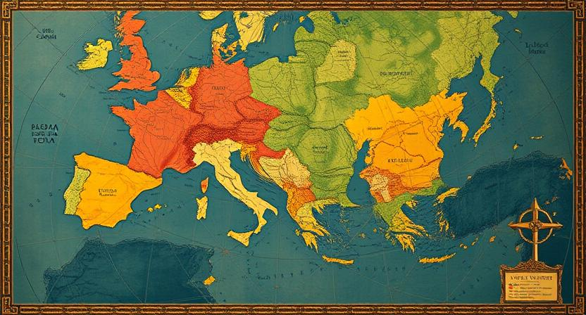
Political Biases in Old Maps
Old maps hold a wealth of historical and cultural information, providing a window into the past that is not only geographical but also political in nature. It is important to note that maps, especially those from the ancient and medieval periods, were not just neutral tools for navigation but were often influenced by the political biases and agendas of the mapmakers and the ruling powers of the time. These biases could manifest in various ways, such as distorting the size or significance of certain regions to serve political interests or promoting a particular narrative that aligns with the ruling authority’s ideology.
Moreover, political biases in old maps can also be seen in the portrayal of borders, territories, and even the labeling of places. Maps were frequently used as tools of propaganda, depicting conquered lands as part of the victorious empire or exaggerating the size and importance of certain territories to assert dominance. These subtle yet powerful manipulations in mapmaking could shape perceptions, justify conflicts, and reinforce the political power dynamics of the era.
• Maps from ancient and medieval periods were not neutral tools for navigation
• Political biases could distort the size or significance of certain regions
• Mapmakers and ruling powers often influenced maps to serve political interests
• Biases could be seen in the portrayal of borders, territories, and labeling of places
• Maps were frequently used as tools of propaganda
• Manipulations in mapmaking could shape perceptions and reinforce political power dynamics
Colonialism and Imperialism in Cartography
Colonialism and imperialism played a significant role in shaping the maps of the world during the Age of Exploration. European powers, driven by the pursuit of wealth, power, and resources, embarked on voyages to chart the unknown lands beyond their territories. As a result, cartographers produced maps that not only represented the newly discovered lands but also reflected the political agendas of their colonial masters. These maps often depicted colonial territories as vast and abundant, reinforcing the narrative of superiority and entitlement held by the colonizers.
The intricate relationship between colonialism and cartography also led to the imposition of Eurocentric perspectives on mapping. Indigenous lands were often inaccurately represented, distorted, or completely omitted from maps, erasing the presence and significance of native peoples. This manipulation of geographic knowledge served to justify colonial expansion and control, perpetuating a distorted portrayal of the world that reinforced the dominance of colonial powers.
• European powers pursued wealth, power, and resources through voyages during the Age of Exploration
• Cartographers produced maps reflecting political agendas of colonial masters
• Maps depicted colonial territories as vast and abundant, reinforcing narrative of superiority
• Eurocentric perspectives imposed on mapping led to inaccurate representation or omission of indigenous lands
• Manipulation of geographic knowledge justified colonial expansion and control
Gender Representation in Cartography
Cartography, as a field historically dominated by male cartographers, often reflected traditional gender roles and biases in its representations. Maps from past centuries commonly depicted male explorers, conquerors, and rulers, while relegating women to secondary or supporting roles, if they were represented at all. This gender disparity in cartographic depictions mirrored the societal norms and power structures of the time, reinforcing the notion of male dominance in exploration and discovery.
Moreover, the lack of female cartographers and geographers in history led to a scarcity of maps highlighting women’s perspectives or experiences. This absence of diverse voices in mapmaking perpetuated stereotypes and limited the representation of the multifaceted roles that women played in shaping societies and civilizations. The underrepresentation of women in cartography not only reflects historical gender inequalities but also underscores the importance of promoting inclusivity and diversity in modern mapmaking practices.
• Despite historical gender biases in cartography, efforts are being made to address the lack of female representation in mapmaking.
• Modern cartographers are increasingly incorporating diverse perspectives and narratives into their maps to promote inclusivity.
• The inclusion of women’s experiences and contributions in cartography helps challenge traditional stereotypes and broaden our understanding of history.
Navigational Challenges in Early Mapping
Early mapping faced numerous navigational challenges due to limited technological advancements and the lack of precise instruments. Navigators heavily relied on the stars and celestial bodies for orientation, making astronomical knowledge crucial for accurate mapping. Inaccuracies in calculating latitude and longitude often resulted in distorted maps and misrepresentations of distances between locations. Additionally, unpredictable weather conditions, rough terrain, and treacherous seas added complexity to the mapping process, leading to inconsistencies in scale and direction.
Explorers and cartographers struggled with the challenge of accurately representing coastlines and landmasses due to the absence of standardized measuring tools. Without the aid of modern devices such as GPS, early mapmakers had to rely on rudimentary methods like pacing, triangulation, and dead reckoning to determine locations. The lack of a universal coordinate system further complicated mapmaking efforts, as each region had its own reference points and measurements. Consequently, early maps often featured distorted shapes and sizes of geographical features, reflecting the navigational challenges faced by explorers of the past.
• Early mapping heavily relied on stars and celestial bodies for orientation
• Inaccuracies in calculating latitude and longitude led to distorted maps
• Unpredictable weather conditions, rough terrain, and treacherous seas added complexity to mapping process
• Explorers struggled with accurately representing coastlines and landmasses without standardized measuring tools
• Rudimentary methods like pacing, triangulation, and dead reckoning were used to determine locations
Technological Advancements in Mapmaking
Throughout history, mapmaking has been greatly influenced by technological advancements. The development of the compass and astrolabe revolutionized navigation, allowing cartographers to accurately plot positions and draw more precise maps. The invention of the printing press in the 15th century made it possible to produce multiple copies of maps, leading to wider dissemination of geographical knowledge. These technological improvements not only enhanced the accuracy of maps but also contributed to the expansion of cartographic knowledge.
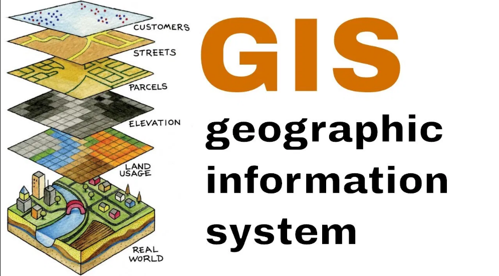
Another significant technological advancement in mapmaking was the introduction of aerial photography in the late 19th century. This innovation enabled cartographers to create more detailed and realistic maps by capturing images from above. The use of satellites and GIS (Geographic Information Systems) in modern mapmaking has further revolutionized the field, allowing for real-time mapping and dynamic representations of spatial data. These advancements have not only made mapping more efficient and precise but have also opened up new possibilities for diverse applications in various fields such as urban planning, environmental monitoring, and disaster management.
• The development of the compass and astrolabe revolutionized navigation
• The invention of the printing press allowed for wider dissemination of maps
• Aerial photography in the late 19th century enabled more detailed maps to be created
• Satellites and GIS technology have further revolutionized modern mapmaking
• Real-time mapping and dynamic representations of spatial data are now possible with advancements in technology
Cartographic Symbols and Legends
Cartographic symbols and legends are essential components of old maps, providing viewers with key information about the land depicted. Symbols such as compass roses, scale bars, and decorative cartouches served both practical and aesthetic purposes, aiding in navigation and embellishing the map’s design. These symbols often held cultural and historical significance, reflecting the cartographer’s worldview and the era in which the map was created. Additionally, legends accompanying the maps explain the meaning of various symbols used, helping users interpret the map accurately.
Intriguingly, some old maps feature hidden symbols and codes, adding layers of mystery and intrigue to the cartographic work. These concealed elements could range from secret messages embedded by the cartographer to deliberate inaccuracies intended to protect geographic knowledge. Unraveling these hidden symbols offers a unique insight into the mindset of the mapmaker and the challenges they faced in representing the world during their time. Such cryptic elements highlight the complexity and artistry involved in the creation of historical maps, inviting viewers to delve deeper into the stories concealed within the cartographic representations.
• Cartographic symbols and legends are essential components of old maps
• Symbols such as compass roses, scale bars, and decorative cartouches served practical and aesthetic purposes
• Legends accompanying the maps explain the meaning of various symbols used
• Some old maps feature hidden symbols and codes adding layers of mystery and intrigue to the cartographic work
• Unraveling these hidden symbols offers a unique insight into the mindset of the mapmaker
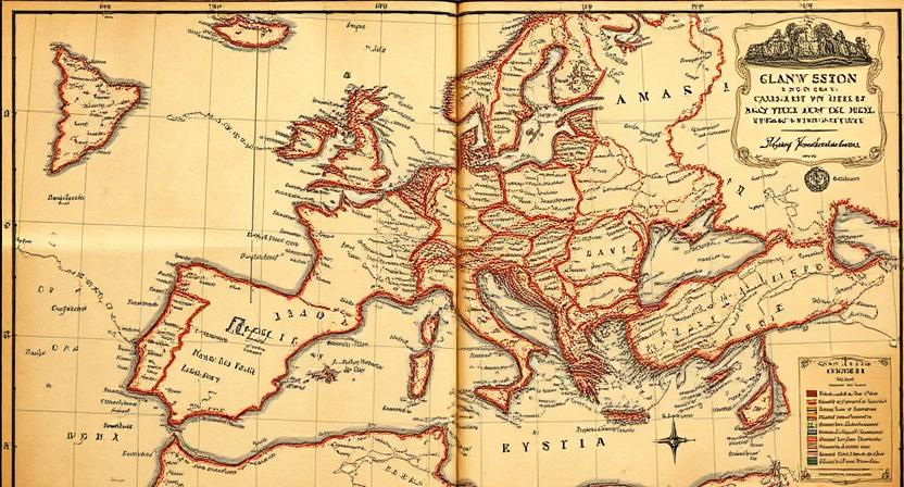
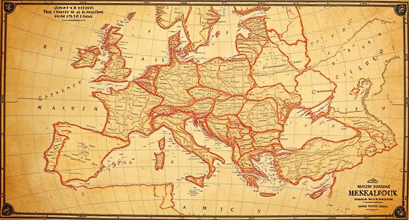
Artistic Elements in Old Maps
Cartography is not merely a scientific endeavor; it is also an art form that has been cherished throughout history. Old maps, often viewed as functional tools for navigation, also hold a wealth of artistic elements that capture the creativity and imagination of their creators. From ornate cartouches and elaborate compass roses to intricate illustrations of sea monsters and mythical beasts, these artistic details add a layer of beauty and intrigue to the maps of yesteryears.
The artistic elements found on old maps not only serve an aesthetic purpose but also provide valuable insights into the cultural, political, and religious beliefs of the societies that produced them. For instance, the elaborate decorations on maps from the Renaissance period often reflected the wealth and power of the ruling elite, while the inclusion of religious iconography underscored the importance of faith in shaping worldviews. By examining these artistic elements in old maps, we can gain a deeper understanding of the societies that created them and the symbolic meanings embedded within their cartographic representations.
• Cartography is a blend of science and art
• Old maps contain intricate artistic elements
• Artistic details add beauty and intrigue to maps
• Decorations reflect cultural, political, and religious beliefs
• Religious iconography emphasizes faith in worldviews
• Examining artistic elements provides insights into societies
Hidden Symbols and Codes in Cartography
Cartography has long been a source of fascination, not only for the accurate depiction of geographical landscapes but also for the hidden symbols and codes that can be found within old maps. These hidden elements often served various purposes, ranging from indicating trade routes and valuable resources to highlighting political alliances and strategic military information. In many cases, these symbols and codes were intentionally placed to convey secret messages or to safeguard sensitive information from falling into the wrong hands.
Explorers and cartographers of the past utilized a variety of techniques to embed hidden symbols and codes within their maps. Some employed cryptic markings or disguised imagery to protect valuable trade routes or pirate hideouts, while others used intricate patterns and elaborate iconography to illustrate mythical lands or hidden treasures. By delving into the world of hidden symbols and codes in cartography, we gain a deeper understanding of the complexity and ingenuity that went into mapping the known world and the mysteries that continue to intrigue historians and map enthusiasts alike.
• Cartography has fascinated people not only for its accuracy in depicting landscapes but also for the hidden symbols and codes within old maps.
• These hidden elements served various purposes, such as indicating trade routes, valuable resources, political alliances, and military information.
• The intentional placement of symbols and codes was often to convey secret messages or safeguard sensitive information.
• Explorers and cartographers used techniques like cryptic markings, disguised imagery, intricate patterns, and elaborate iconography to embed hidden symbols.
• Delving into the world of hidden symbols and codes in cartography allows us to appreciate the complexity and ingenuity behind mapping the known world.
Cultural Perspectives in Map Interpretation
Maps have always been a reflection of the cultural perspectives of the societies that created them. Different cultures have unique ways of interpreting and representing geographical spaces on maps. For example, indigenous cultures often see the land as a living entity and incorporate spiritual beliefs into their mapping practices. These maps may focus more on sacred sites and natural landmarks rather than strict geographical accuracy.
In contrast, Western societies have traditionally emphasized scientific accuracy and precision in their maps. European cartographers, for instance, were influenced by the Age of Exploration and sought to create maps that accurately represented newly discovered lands. This cultural perspective prioritized conquest and colonization, shaping the way these maps depicted the world and its people. It is important to consider these cultural perspectives when interpreting historical maps, as they provide valuable insights into the beliefs and values of past societies.
• Indigenous cultures often view land as a living entity
• Incorporate spiritual beliefs into mapping practices
• Focus on sacred sites and natural landmarks rather than geographical accuracy
• Western societies emphasize scientific accuracy in maps
• European cartographers influenced by Age of Exploration
• Prioritize conquest and colonization in map representation
By understanding the cultural perspectives behind map interpretation, we can gain a deeper appreciation for the ways in which different societies have viewed and interacted with their environments. Maps not only serve as tools for navigation but also as windows into the worldviews of those who created them. Whether it be through spiritual connections to the land or scientific exploration, each culture brings its own unique perspective to mapmaking that shapes our understanding of geography and history.
Mythical Lands and Creatures on Old Maps
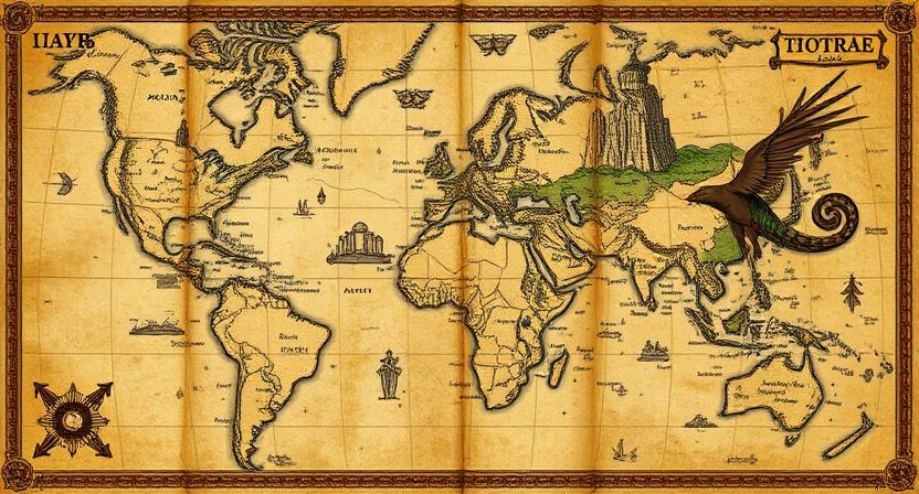
Maps from centuries past often depict fantastical creatures and lands that sparked the imagination of those who gazed upon them. These mythical elements added a sense of wonder and mystery to the maps, blending the lines between reality and fiction. From sea monsters lurking in uncharted waters to mythical islands populated by exotic creatures, these embellishments reflected the beliefs and folklore of the era in which they were created.
In addition to decorative elements, mythical lands and creatures on old maps served practical purposes as well. They often denoted unexplored territories or areas of danger, warning sailors and travelers of potential risks and unknown perils. These cartographic embellishments not only added an element of intrigue to the maps but also acted as visual cues for navigators, guiding them through treacherous waters and unfamiliar lands.
• Maps from centuries past often depict fantastical creatures and lands that sparked the imagination of those who gazed upon them.
• These mythical elements added a sense of wonder and mystery to the maps, blending the lines between reality and fiction.
• Sea monsters lurking in uncharted waters and mythical islands populated by exotic creatures were common embellishments on old maps.
• Mythical lands and creatures served practical purposes as well, denoting unexplored territories or areas of danger.
• They acted as visual cues for navigators, guiding them through treacherous waters and unfamiliar lands.
Navigating the Unknown: Terra Incognita on Maps
Navigating the vast expanses of uncharted territories on historical maps often led cartographers and explorers into the realm of Terra Incognita, the unknown land. These blank spaces on maps sparked curiosity and prompted daring adventurers to set sail into uncharted waters or trek into unmapped lands, searching for new treasures, resources, and knowledge. The presence of Terra Incognita on maps symbolized the limits of human knowledge and the inherent desire to expand horizons beyond familiar territories, fueling the spirit of exploration and discovery that defined the Age of Exploration.
The depiction of Terra Incognita on old maps also served as a reflection of the prevailing beliefs, fears, and aspirations of the time. While some saw these uncharted regions as opportunities for wealth and glory, others viewed them with suspicion and apprehension, attributing mystical or dangerous qualities to the unknown lands. The presence of mythical creatures, fantastical landscapes, and mysterious symbols in the blank spaces of maps added layers of intrigue and wonder to the collective imagination, feeding into the lure of the unknown and inspiring further expeditions into uncharted territories.
• The blank spaces of Terra Incognita on maps symbolized the limits of human knowledge
• Explorers were driven by curiosity and a desire to expand horizons beyond familiar territories
• Some viewed uncharted regions as opportunities for wealth and glory, while others saw them with suspicion and fear
• Mythical creatures, fantastical landscapes, and mysterious symbols in blank spaces added intrigue and wonder to exploration
Evolving Worldviews through Cartography
Maps have long been essential tools for shaping and reflecting human understanding of the world around them. As civilizations expanded and interacted with new lands and cultures, their maps evolved to accommodate these changing perspectives. The portrayal of distant lands, navigational routes, and even mythical territories on old maps offers a glimpse into the evolving worldviews of different societies throughout history.
Through cartography, societies were able to visualize their place in the world and assert dominance over territories. Maps were not only practical navigational aids but also powerful instruments for conveying political, religious, and cultural ideologies. The evolving worldviews captured in old maps reflect the complex interplay between exploration, conquest, and the quest for knowledge, illuminating the shifting paradigms that have shaped our understanding of the world.
• Maps have long been essential tools for shaping and reflecting human understanding of the world around them.
• The portrayal of distant lands, navigational routes, and even mythical territories on old maps offers a glimpse into the evolving worldviews of different societies throughout history.
• Through cartography, societies were able to visualize their place in the world and assert dominance over territories.
• Maps were not only practical navigational aids but also powerful instruments for conveying political, religious, and cultural ideologies.
• The evolving worldviews captured in old maps reflect the complex interplay between exploration, conquest, and the quest for knowledge.
Reinterpreting Maps through a Modern Lens
In the realm of cartography, the process of reinterpreting old maps through a modern lens serves as a captivating endeavor that unveils layers of historical and cultural narratives. By scrutinizing these antiquated cartographic representations from a contemporary perspective, we gain insights into the minds of ancient mapmakers and the societies in which they thrived. As we delve into the intricate details of these aged maps, we unearth forgotten stories and the ethos that shaped the worldviews of past civilizations.
Through the lens of modern scholarship and technology, the reinterpretation of old maps offers a fresh avenue for understanding the complexities of human interaction with the world around them. By examining the spatial relationships, symbolic depictions, and geographic inaccuracies present in these ancient cartographic relics, contemporary scholars can reconstruct the past through a new framework. This process not only enriches our comprehension of bygone eras but also sheds light on the evolution of cartography as a discipline.
• By analyzing the placement of cities, landmarks, and borders on old maps, historians can uncover political dynamics and power structures of ancient societies.
• The use of modern GIS technology allows for a more accurate reconstruction of historical landscapes depicted in ancient maps.
• Reinterpreting old maps through a modern lens can also help us understand the cultural beliefs and worldviews of past civilizations.
• Comparing ancient cartographic techniques with contemporary mapping methods highlights advancements in scientific knowledge and technological innovation over time.
The Legacy of Old Maps in Contemporary Society.
Maps from ancient civilizations continue to intrigue modern society with their historical significance and intricate designs. These old maps provide a glimpse into the worldview and knowledge of past societies, offering valuable insights into their cultural, political, and social contexts. By studying these maps, researchers and historians can trace the evolution of cartography and understand how the perception of the world has evolved over time.
Moreover, the legacy of old maps in contemporary society extends beyond historical curiosity, influencing art, literature, and even video games. The artistic elements and hidden symbols in old maps have inspired creatives to incorporate cartographic motifs into their work, adding a touch of mystery and adventure. Additionally, the portrayal of mythical lands and creatures on old maps has captured the imagination of storytellers and sparked the creation of fantastical worlds in modern narratives.
• Old maps offer valuable insights into the cultural, political, and social contexts of past societies
• Researchers and historians can trace the evolution of cartography through studying ancient maps
• The legacy of old maps influences art, literature, and even video games in contemporary society
• Cartographic motifs from old maps inspire creatives to incorporate them into their work
• Portrayal of mythical lands and creatures on old maps spark creation of fantastical worlds in modern narratives
